
- Հեռավորությունը
- 22 կմ
Marina · Ամերիկայի Միացյալ Նահանգներ
Monterey Bay: ինչ կա շուրջը, ինչպես հասնել և երբ գնալ · 2026
Settling along this shoreline means planning daily commutes around coastal highway bottlenecks and relying on regional road transit to reach larger metro centers.
Ինչ կա շուրջը3
Փոխարժեք1,00 $02 նոյ, 2026 թ. դրությամբ
Վայրի մասին
The shoreline defines everyday regional transit along central California.
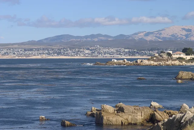
Monterey Bay forms an open indentation of the Pacific Ocean south of the San Francisco Bay Area. Daily travel between shoreline settlements relies heavily on primary coastal corridors, meaning routine drives depend entirely on conditions along CA 1 and US 101.
Կարդալ ավելին
Residents looking toward major metropolitan hubs head north toward San Francisco along these arterial highways. The surrounding communities also supplied the official designation for Apple desktop computer operating software known as macOS Monterey.
Ասոցիացիաներ
- CA 1
- macOS Monterey
- Highway reliance
Փաստեր
- Monterey Bay opens onto the Pacific Ocean south of the San Francisco Bay Area.
- San Francisco lies north along highway connections via CA 1 and US 101.
- Apple named its desktop release macOS Monterey after this coastal area.
Monterey Bay նկարներում8 լուսանկար · 1 վայր
Ինչպես հասնել և որտեղ մնալ
2 աղբյուր · Առ 04 նոյեմբերի, 2026 թ.
Աղբյուր՝ TravelHub · OurAirports (public domain)
Նմանատիպ մոտակայքում
 ≈ 1 ժ 15 ր հեռավորության վրաՍան Խոսե
- Ամիս
- ≈ 5502 $
- Հեռավորությունը
- 60 կմ
 ≈ 3 ժ 50 ր հեռավորության վրաԼոնգ Բիչ
- Ամիս
- ≈ 3067 $
- Հեռավորությունը
- 477 կմ
Ամերիկայի Միացյալ Նահանգներ-ի քաղաքները
Վայրեր Monterey Bay-ում
Հարակից երկրներ
Հաճախակի տրվող հարցեր Monterey Bay-ի վերաբերյալ
Չե՞ք գտնում անհրաժեշտ վայրը: Որոնումը հասկանում է ցանկացած լեզու: Բացել որոնումը