








Governors Island, New York Just 5 minutes from Manhattan lies the small Governors Island, a piece of the 19th century frozen in time. One fine Sunday, after reading about it in a brochure, we headed downtown and caught the ferry. That day, as part of a summer festival, there was a Shakespeare play—an amateur open-air theater. There are no cars or crowds of tourists with cameras on this island. People come here to cycle on traffic-free roads, have a picnic, and gaze at the Manhattan skyscrapers, which look like miniature models right in the palm of your hand. But that's not all. When you arrive, you immediately feel lost and don't even realize why at first. An atmosphere of past centuries reigns there. All the buildings on the island are low-rise and built long ago; with columns, stucco, and surrounded by sprawling trees and winding paths that aren't constrained by straight concrete sidewalks, they look like European estates with a dusty touch of antiquity. Who lives in them? What was there? I read about it later. At the time, we walked around a bit enchanted and surprised. A Shakespeare play, people sitting on the grass, the sun, old buildings—whoever says there is no nature in New York simply hasn't seen everything. So, Governors Island lies one kilometer from the southernmost point of Manhattan, and, by the way, it is legally part of the borough of Manhattan. In the summer, the island is open to the public, and you can get there by taking a free ferry. Ferries run every half hour or hour from the southern tip of Manhattan; they depart from the Battery Maritime Building, which is next to the Staten Island Ferry. Many people bring their own bicycles, and while waiting to board, the crowd splits roughly in half—"pedestrians" and "people with transport," with separate lines for each. On Fridays, you can rent a bike for free on the island (a system that also exists in some places in Manhattan—you take a bike, swipe your plastic card just to leave your details in case of non-return, and if you return it on time, no money is charged). From the 18th to the 20th century, the island served military purposes. There were forts, military fortifications, and, accordingly, houses for the command staff. Before the construction of the first city airport, Floyd Bennett Field, in Brooklyn, it was assumed it would be built on Governors Island. And indeed, from 1950 to 1960, a small runway for military aircraft was located there. In 1985, the island was officially recognized for its historical value. In December 1988, a meeting between Ronald Reagan, George H.W. Bush, and Mikhail Gorbachev took place there. In 2003, the military transferred control of the island to the New York state authorities for a symbolic sum of $1, and Governors Island was opened to the public. More facts and stories in English (or Ukrainian) can be found on Wikipedia: http://en.wikipedia.org/wiki/Governors_Island. I will add once again that this place is little known to ordinary tourists; you can find completely deserted lawns even on weekends. Excellent views, a postcard panorama, one of the best views of Manhattan. And a brood of geese wandering through a field with skyscrapers in the background is an unforgettable experience! P.S. I also met an American girl—a Chucky bride—whose dad is in the military, which is why such families move very often; in her 20 years, she has managed to live in or visit almost every state, but she was born and raised on this island!
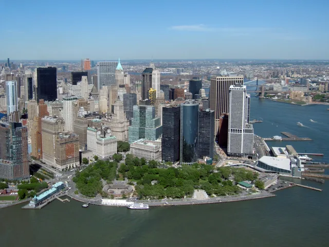
The Battery: what's nearby, how to get there and when to go · 2026
Residents trade quiet mornings along the seawall for wall-to-wall tour queues by noon, learning quickly to take their waterfront walks before the ferry crowds take over the paths.
Coastal winds and maritime pedestrian corridors define the park edge.
The Battery establishes an open waterfront perimeter at the edge of New York, catalogued in geographic records as a dedicated public expanse. People residing in nearby quarters utilize the paths for direct access to open water and maritime sightlines without admission fees. The grounds function as an essential pedestrian crossing where dense high-rise avenues terminate into open harbor winds and coastal transit points.
Read on
Long-term stays in the vicinity require navigating persistent crowds and maritime exposure. Large volumes of international travelers gather across the promenades throughout daylight hours, producing congested walkways and sustained noise along the water. Cold sea winds during winter months reduce outdoor utility, while summer humidity brings heavy tour groups. The open green space compensates for cramped domestic apartments nearby.
- Waterfront promenade
- Tour queues
- Harbor exposure
- Open public grounds
- The Battery is documented in geographic registries as an open municipal expanse in New York.
- Public records catalog a defined physical area measurement for the park territory.
- Standard entry frameworks permit visa-free access for designated foreign nationalities.
Getting there and staying
2 sources · As of November 3, 2026
People who have been here

Google reviews
What visitors say on Google Maps
Rating and recent reviews from Google Maps load on request.
Similar nearby
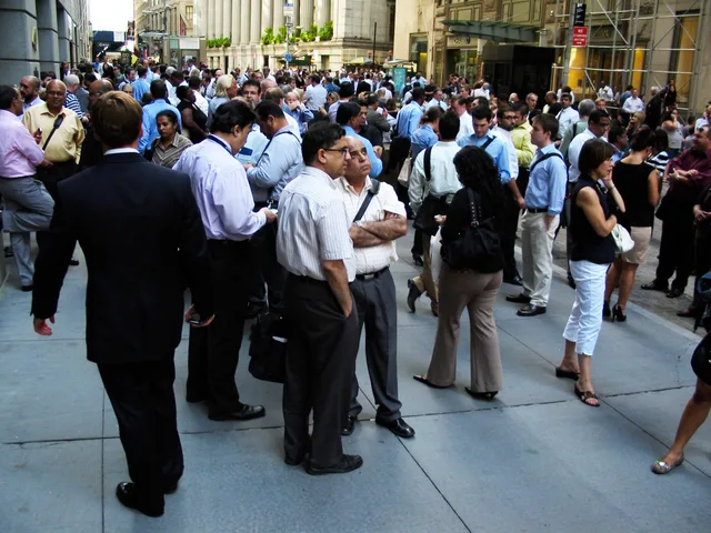 ≈ 10 min awayWall Street
- Distance
- 700 m
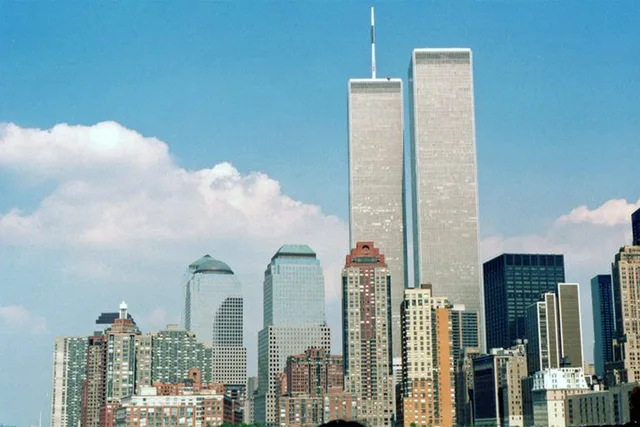 ≈ 15 min awayWorld Trade Center
- Distance
- 900 m
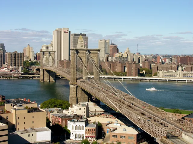 ≈ 25 min awayBrooklyn Bridge
- Distance
- 1.7 km
Cities of United States
Places in The Battery
Countries nearby
Frequent questions about The Battery
Can’t find the place you need? Search understands any language. Open search