İçeriğe geç
TravelHub
Yaşa

Lomé: Seyahat rehberi, fiyatlar ve ücretsiz konaklama · 2026

Lomé is the capital and largest city of Togo. It has an urban population of 837,437 while there were 2,188,376 permanent residents in its metropolitan area as of the 2022 census.

Lomé · CC BY-SA 4.0

Şu an şehirdeLomégün batımı 17:35
GirişPasaport seçinCevap pasaporta göre değişiklik gösterir.
Haritadaki yerler6
Döviz kuruF CFA 585,951 $ içinXOF — ülkenin para birimi2 Kas 2026 verilerine göre
Harita yükleniyor

Ulaşım ve konaklama

2 kaynak · 3 Kasım 2026 tarihi itibarıyla
Kaynak: TravelHub · OurAirports (public domain)

Vize ve pratik bilgiler

Bir pasaport seçin

Pasaportunuzu seçin — işlem süresi, ücret ve belgeler pasaporta göre değişiklik gösterir.

Güvenlik ve sağlık

Güvenlik · resmi tavsiye3 Kas 2026 verilerimize göre
Birleşik Krallık Dışişleri Bakanlığı (FCDO)Ülkenin bazı kısımlarına seyahatten kaçınınÜlkenin belirli bölgelerine seyahat edilmemelidir.
Uyarı metninin tamamı (İngilizce)

FCDO now advises against all travel to within 30km of the border with Burkina Faso except for the city of Dapaong and the N1 highway leading to it from the south and FCDO now advises against all but essential travel to the rest of the Savanes Region (‘Warnings and insurance’ page).

ABD Dışişleri BakanlığıSeviye 2Çevrenize ve eşyalarınıza her zamankinden daha fazla dikkat edin.
  • terörizm
  • adam kaçırma
  • sağlık riskleri
Uyarı metninin tamamı (İngilizce)

Exercise increased caution in Togo due to risk of crime, terrorism, unrest, kidnapping , and health . Some areas have increased risk. Read the entire Travel Advisory. The U.S. government has limited ability to offer emergency or routine services to U.S. citizens outside of Lome due to the safety risks. U.S.

Kaynak: UK FCDO Foreign Travel Advice · US Department of State Travel Advisory

Ulaşım

UlaşımOurAirports (public domain)
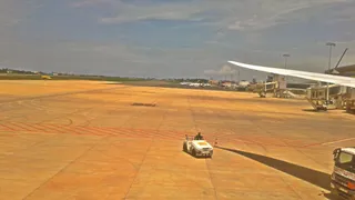
Lomé–Tokoin International Airport LFWMerkezden 5,5 km uzaklıkta
Cotonou Cadjehoun International Airport COOMerkezden 131 km uzaklıkta
Kotoka International Airport ACCMerkezden 164 km uzaklıkta

Burada bulunmuş insanlar

Кириллstriklend · Oku
40) RANK 22. Lassen Volcanic and Crater Lake National Parks

Who would have thought that America is so diverse... Besides the family-friendly Myrtle, posh Miami, bustling New York, and colorful Vegas, there are places here that America itself seems not to have reached yet... We were driving north from San Francisco and were surprised to learn that everything here is a zone of high volcanic activity. Not just "here," but the entire top-left corner of the USA on the map. No, we had heard about the monstrous earthquake in San Francisco at the beginning of the century and the Los Angeles tremors, but we never expected to see remnants of magma and rocks scattered by eruptions for hundreds of kilometers))) How do you know if you are far from Lassen Volcanic National Park? It's very simple!! 1) Black dots of rocks will start appearing in the usual yellow-brown landscape outside the window. Here and there. It's unclear who put them there. 2) Burnt-out gas stations will appear, selling gas three times cheaper than usual and filling you up directly from a huge pipe laid somewhere further. 3) One morning, the bed will shake along with the walls of the house so that you wake up realizing that seismology is a useful science)) At least that's how it was for us=) The park itself is a bunch of old rock-ash with a large volcano in the middle and small stinky sulfur vents on the sides. We only stopped there because it was very much on the way. Otherwise, only if you have tons of time. This landscape will get boring after 3 days)) What's cool are the mega-blue lakes with the entire periodic table inside. You shouldn't swim, but looking is fine. Without their blueness, the eye would have died of boredom. Oh, how!) Therefore, we didn't linger there (and there was nowhere to stay anyway), and we rushed to the main point of the day - Crater Lake. We didn't know then that it would be one of the main points of the entire trip... We arrived there just in time, about 2 hours before sunset, so we managed to take the best spot in the world - on the top of a volcano that exploded several thousand years ago. Impressive, right?) The story is: a long time ago (6000 years ago), the local largest volcano stood here (one of the largest in the world at that time). Then it went and erupted. And it blew off a kilometer of itself with all its insides. Groundwater rushed to extinguish it, and that's how the 9th deepest lake in the world and the first in North America - Crater Lake - was formed. 594 meters of one of the purest water treasures on the planet. Imagine. You are driving, the road is constantly going slightly up. The forest is interspersed with huge rocks. Suddenly you finally drive out to a height that the trees have not overcome in these millennia. Here is crushed stone and bare earth. Nothing else is visible. You drive up to the edge of the hill, behind which, of course, there should be another hill, and you drop your jaw. Below you is a 10-kilometer lake in a crater, with an island in the center just like in a picture. The island, as expected, is called Wizard Island.) The water reflects only the sky simply because it has nothing else to reflect. You climb to the very top of the rim left by the volcano and watch one of the most beautiful sunsets in your life. You can see far, far away, the scorched earth turns crimson red, as if reliving those events of 6000 years ago again. A giant shadow moves over the lake and poof!!! The sun is gone. Yeah)) The road to the top takes 15 minutes, with stops and photos - 40 minutes. The viewpoint is Watchman lookout. There are many of them there, but this one is definitely the coolest, be sure to visit it. And then you get in the car and drive to Yellowstone. At least, that's how it was for us...

  • Кирилл tarafından yapılan gönderiden fotoğraf
  • Кирилл tarafından yapılan gönderiden fotoğraf
  • Кирилл tarafından yapılan gönderiden fotoğraf+2
3
Кириллstriklend · Oku
37) PLACE 19. The road to San Francisco.

Outside the window is a typical California and, in general, American landscape. If it's not mountains with forests, then it's semi-deserts with fields. In California, as everywhere in the western half of the country, it is very dry. In the autumn, small lakes are just traces of dried-up algae. Only specially irrigated areas are green here; otherwise, it's dry land with yellow, brittle grass 10 cm high... And it was even cooler to come across a real golden field on the road to San Francisco. With grass, albeit short, but thick, flooded with sun and wind, blinding as far as the eye can see... This field became the cover of this album. I haven't felt such silence and contentment with life anywhere else. You just flop onto the ground and stare at the sky. Ah... Then we got up and, after driving another 50 kilometers, we saw an orange paradise on the side of the road. I mean, an orchard) Which supplied us with 20 kg of delicious and juicy oranges. We ate them for another 5 days, oh, these were the tastiest oranges we've ever eaten in our lives, and let anyone try to say I'm lying...))) Another 50 kilometers later, we pick flowers in a granny's garden and tuck them into our hair. "If you're going to San-Francisco, you should wear some flower in your hair..."

  • Кирилл tarafından yapılan gönderiden fotoğraf
  • Кирилл tarafından yapılan gönderiden fotoğraf
  • Кирилл tarafından yapılan gönderiden fotoğraf+2
Кириллstriklend · Oku
29) RANK 11. ARCHES AND MONUMENT VALLEY

Arches and Monument Valley turned out to be the two coolest, brightest, and most memorable places for us in America. And as it usually happens, that's exactly when our camera died.)))))) We had to take photos with a 0.3-megapixel camera. Better not to have taken any at all))) But let's take things in order. (The photos I posted were downloaded from the internet just so you could imagine what it looks like.) On the morning after the Rocky Mountains, we continued our journey along the road running through the Colorado River Canyon, right above the current. Then we drove onto a road through the desert (the American desert—read our semi-desert—is characterized by the expression "not thick, not empty"). Stopping was forbidden here due to frequent sandstorms. We weren't planning on it anyway.) Another 20 minutes of driving and we enter Arches National Park. Rocks and sand all around, everything a rich copper color. Noon, the sun is baking, and it becomes clear why everything around is so red. "The iron and copper content gives it blah-blah-blah..." they will tell you—don't believe it. With this sun, anything would be red, even a waffle towel or Michael Jordan!! The first point is the Broadway. A flat valley 3 kilometers long and 400 meters wide, with sheer rock walls on both sides about 300 meters high. It looks insane against the blue sky, so we don't let our cameras out of our hands. Exhausted Asians are scurrying around, making us envious as they snap photos with cool, high-end cameras)) The view from the valley is even cooler. The sky is divided into 3 equal parts. Two crimson and one saturated blue. You can't stand with your head tilted back for long, so after 20 minutes of climbing around the nearby area, we head to the car. Talking about the park and trying to describe it is a waste of time. I'll just note—there are about 2,000 natural arches here. A couple of dozen of them are huge and super cool. I must say that you are obligated to do at least one thing here—hike to Delicate Arch. It is located on a flat plateau on top of a mountain. It's visible from everywhere, but that's not the same as when you look at everything around from it. It's a 4-kilometer hike uphill, though. It will be very tough. I promise) People dying, lying under 20-centimeter bushes, will be begging for water. Your legs will magically turn into cotton. Sweet voices in your head and behind you will be begging you to turn back. Don't listen and keep going! Sing Malinin's songs to yourself, play chess in your mind, imagine yourself as Bruce Willis saving the planet—in short, do anything, but make it there. It is so worth it that it's hard to even imagine. It's not for nothing that this arch became the symbol of Utah—if it were something else, I would be offended) Right by the Arch is a kilometer-deep cliff. The whole park is like in the palm of your hand. You can sit in safety if you don't like extreme sports, or you can walk along the edge a couple of times and stand on one leg for a photo—decide for yourself. But you have to climb up, that's all there is to it. Also, among the most outstanding places, one should note Double Arch, Landscape Arch in Devil's Garden, and Balanced Rock. Just for this, it will take 7-8 hours at a normal pace, because you can climb everything here, squeeze through everywhere, and since you can, arch after arch, hill after hill—and you've already lost a couple or three hours that you expected to spend on a hearty lunch). Anyway, with numerous sighs and delights, we leave the park around 4 o'clock—after all, today we still need to make it to the sunset in Monument Valley!!! We expect to see more rocks, nothing special, just pieces of stone sticking out of the ground. Yeah. Right. As we approach the Valley, everyone's jaw drops. No one expected to see THIS. I think this is the coolest, coolest, coolest, coolest thing I've seen in the USA. Maybe it's because we arrived at sunset and twilight, I don't know. But if someone tells me th

  • Кирилл tarafından yapılan gönderiden fotoğraf
  • Кирилл tarafından yapılan gönderiden fotoğraf
  • Кирилл tarafından yapılan gönderiden fotoğraf+2
Кириллstriklend · Oku
19) PLACE 1. The road to Florida

It's August 18th, which means it's time to go. Because of work, I need to be back in Myrtle in a week, so Florida is our first stop, and then the rest of the USA on the list.) Charleston was the first on our route. If you're in the area, stop by, but it's not worth a special trip. It's cute, lots of early 18th-century buildings, an aircraft carrier docked at the pier, and an old market. It's cool, especially with the constant sunny weather, but our path led further south since we'd already been to Charleston and wanted something more, just like in our dreams.. For the first couple hundred kilometers, you don't even realize what you're about to do. The GPS says "Keep left in 532 kilometers")) but that doesn't bother us.) We're driving through forests at a cruising speed of 170. Can't wait to go faster)) Florida is a former Spanish territory, so we're taking the first scenic road that runs right along the eastern edge of the peninsula, past old forts. As soon as we reach the sea, we run to the beach. It's surprisingly similar to Myrtle Beach. We help a lifeguard girl drag her tower further back (which is 5 times heavier than the ones our lifeguards have in Carolina) and continue our journey. We see a crushed armadillo. Very sad. In general, in America, there are roadkill animals every 3 kilometers. Thank God we even saved a rabbit back in Wyoming (that scary story is for later)). There are planted palm trees in the cities, but none outside of them. Actually, to my surprise, eastern Florida isn't very palm-y. It's forested and grassy, but not palm-y. Golden sand (not soft, but golden=) and blue sea - that's not about these places. The old forts are cool, but they are all the same and very small; it's worth looking at a couple. Pick any you like) But we pass through a very cool town of millionaires somewhere near Palm Bay; the road goes under overhanging trees, and sometimes the ocean peeks through. After about 2 hours, we get bored and head back to the highway - because we need to make it to the hotel today. At the same time, all the radio stations are shouting about a hurricane. For now, it's bright and sunny for us. Which means tomorrow is Miami and the coral reefs)

  • Кирилл tarafından yapılan gönderiden fotoğraf
  • Кирилл tarafından yapılan gönderiden fotoğraf
  • Кирилл tarafından yapılan gönderiden fotoğraf+2
ravikOku
South Africa, Cape Town

CHAPTER ONE. BEFORE I KNEW… "Do not pity the dead. Pity the living, and above all, those who live without love." J.K. Rowling. September 22, 2008. Hello, everyone! Glad to see those who are glad to see me! "So THAT'S IT: It doesn't get to me! It never gets to me, if ANYTHING," as the song goes. I would never advise my friend Uncle Tyoma to come to South Africa — to Cape Town. He would die here. From delight. Because the mountains here are just... wow!!! "Lion’s Head" (670 meters), the mountain on the left with the peak. To the right of Lion’s Head is Signal Hill (350 meters), which got its name from the cannon standing at its foot, firing from Monday to Friday at noon. Table Mountain (1086 meters), from the center to the right — a dozen mountain peaks called the "Twelve Apostles." Their height is about a kilometer. It is 18:30 local time now. That means it's 8:30 PM in Moscow and 10:30 PM in Chelyabinsk. The day is hot, the night is very cold — such is, apparently, the South African spring. They say it's the height of summer here in December and January. Today we had a walking tour of Cape Town and a meeting with the program organizers. Everything went interestingly. The only thing that was a bit stressful: my head was spinning because I had to force it to work wildly all the time, trying to understand what was being said. Sometimes I succeeded. No, of course, I understand — the guides talk a bit too much, and the SASTC people (organizers) too, but still — when will I finally start speaking English normally?! A personal thank you to Mr. Dragunkin — a mega-guy, whose audio course helped me master at least some grammar. Thanks to him, I understand a little and even speak. If I happen (actually) to understand what is being said to me, or what I am being asked, and manage to answer myself, even if relatively primitively, BUT I succeed — it's pleasant. People! If you are planning to go to Africa or any other English-speaking country in the near future — don't be as lazy as I am. Learn English! Well, and how did I get here, and in general? I'm walking around today and thinking, "What was I waiting for so long? Why didn't I come here sooner? It's stunning here!" If anyone doesn't know — Cape Town was founded about 350 years ago. The first settlements, it's not hard to guess — were built by Europeans. The Dutch, the British, and maybe someone else (too lazy to look at the guidebook again, I read it about a month and a half ago and didn't even finish it). It must be precisely why it looks a bit like a modern English city (especially with its churches and left-hand traffic). It reminds me a bit of Europe, with its good roads. Also, South Africa is very similar to Russia (strangely enough). Especially to "seaside" Russia. And another feeling... as if you are at home. And this is tens of thousands of kilometers from Chelyabinsk! And South Africa is similar to Russia in prices — well, exactly the same as ours. This is especially pleasant for me — having seen that prices in Europe and the USA are very different from ours, they are even significantly more expensive than Moscow ones, let alone Chelyabinsk. The city of Cape Town is located at the foot of the 1086-meter ↑ "Table Mountain". I flew with Emirates airlines with a layover in Dubai. I liked the flight. These airlines are, of course, not British, but very, very decent. On the display, I read: flight time — five hours to Dubai; and another ten — to Cape Town. The distance, if you add up both flights, judging by the display, came to about 50,000 kilometers. The altitude was about 11,400 meters, and we reached speeds of up to 930 km/h. For those who don't know much about this — that's a lot, high, and fast. However, large Boeings always fly with such indicators. I spent the night at Dubai airport (in my opinion, it's not as luxurious as in Moscow or London, but still "up to standard"). And you can get enough sleep on the soft benches, especially considering that I only had carry-on lugga

  • ravik tarafından yapılan gönderiden fotoğraf
Aliaksandra Siniauskayasinyavskaya.alex · Oku
Alexandra on Instagram: "Participating in the contest from @iec_minsk Video 'If songs were about my job in the USA' P.S. All numbers were checked on time))) Some interesting facts about my work this season: 1. At work, I walked 1 million 2"

Alexandra on Instagram: "Participating in the contest from @iec_minsk Video 'If songs were about my job in the USA' P.S. All room numbers were checked on time))) Some interesting facts about my work this season: 1. At work, I walked 1 million 215 thousand 439 steps or 861 kilometers. And that's only when I had my phone with me))) 2. I worked at least 1096 hours 3. This summer I checked more than 3528 rooms))) Too bad I didn't count how many freezers were defrosted and how many floors were swept))) Video: https://www.instagram.com/reel/DBEQB_kIRIE/?igsh=MXYyMW84bDA3dDc1dQ=="

4katılımcılardan gönderiler hakkında Lomé — konaklama ve vizelerden hafta sonu rotalarına kadar.Hepsini oku

Yakındaki benzer yerler

Aradığınız yeri bulamadınız mı? Arama motoru her dili anlar. Aramayı aç