





 ≈ 10 min drogiPNC Park
- Odległość
- 700 m
 TravelHub
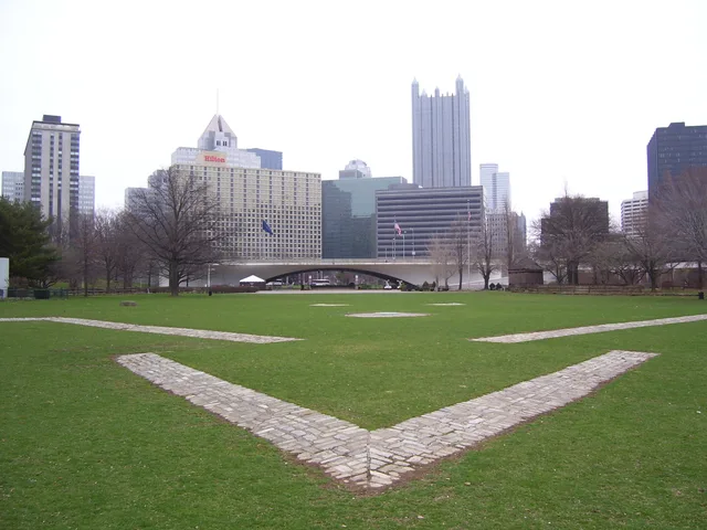
Downtown residents treat the park grounds as an everyday jogging corridor, dodging crowds that gather along the granite outlines between the riverfront trails.
French troops erected Fort Duquesne after dismantling an English trading post at the forks of the rivers to secure the Ohio Valley. Designed on the plan of Fort Frontenac, the wooden stronghold anchored French claims linking Quebec with Louisiana. The outpost triggered military clashes with Virginian militia led by George Washington, marking the outbreak of the French and Indian War across the frontier.
Holding the forks proved difficult because the riverbank suffered from marshy ground and frequent flooding. Surrounding river bluffs exposed the garrison to artillery bombardment from the higher shore. When British forces advanced, the defenders destroyed the fort rather than surrender it. Point State Park preserves the site today, using stone markers set into the lawns to show where the defensive walls once stood.
Co piszą odwiedzający w Mapach Google
Ocena i najnowsze opinie z Map Google wczytają się na żądanie.
Nie możesz znaleźć miejsca, którego potrzebujesz? Wyszukiwarka rozumie każdy język. Otwórz wyszukiwarkę