跳转至内容
TravelHub
黑山城 · 美国

米切爾峰: 周边有什么、如何前往、何时最合适 · 2026年

Living at the base of the Black Mountain range requires private transport along mountain roads, but you gain immediate access to Eastern America's highest ridgeline.

地点地图
周边3
汇率$1.00每 1 $USD — 该国货币截至 2026年11月2日
正在加载地图
关于此地

The highest summit in the Appalachian chain anchors a dense spruce-fir highland inside state park boundaries.

Mount Mitchell rises as the highest peak in the Appalachian Mountains and the tallest point in North America east of the Mississippi River. The mountain stands inside Mount Mitchell State Park, bordered on all sides by the federally managed Pisgah National Forest. Cherokee residents historically called the summit Attakulla before European-American settlers termed it Black Dome.

继续阅读

Road access branches off the scenic Blue Ridge Parkway along a dedicated state route leading up to summit parking facilities. A paved footpath climbs through native conifer forest straight to an elevated public observation deck. Long-term stays nearby in the Black Mountain range demand preparation for rapid weather changes and limited mountain road access in rough weather.

相关组织
  • Blue Ridge ParkwayThe scenic roadway provides the only vehicular approach corridor to the peak.
  • Summit observation deckPlatform constructed on the highest point provides views across the range.
  • Severe mountain weatherExposed elevation brings sudden cold, strong wind, and treacherous transit.
事实信息
  • The mountain constitutes the highest geographic elevation in mainland North America east of the Mississippi River.
  • The Cherokee people historically occupied the surrounding homeland and named the peak Attakulla.
  • Mount Mitchell State Park protects the mountain territory alongside the surrounding Pisgah National Forest.
  • A state highway directly links the mountain summit parking area to the Blue Ridge Parkway.
来源:Wikipedia
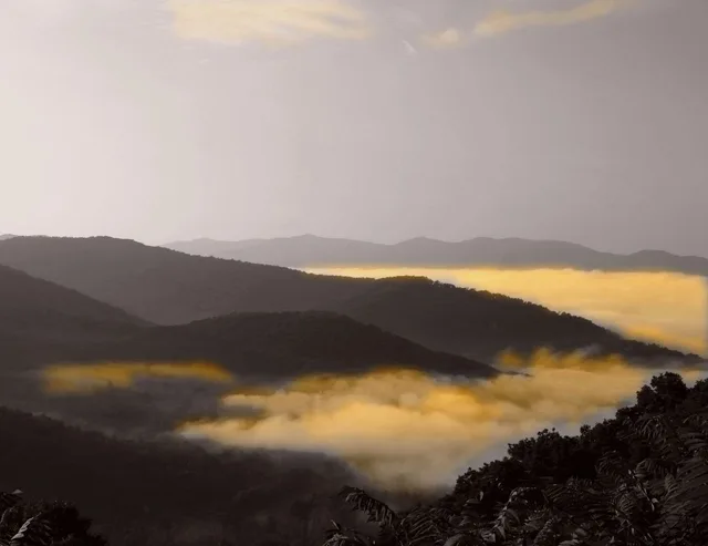
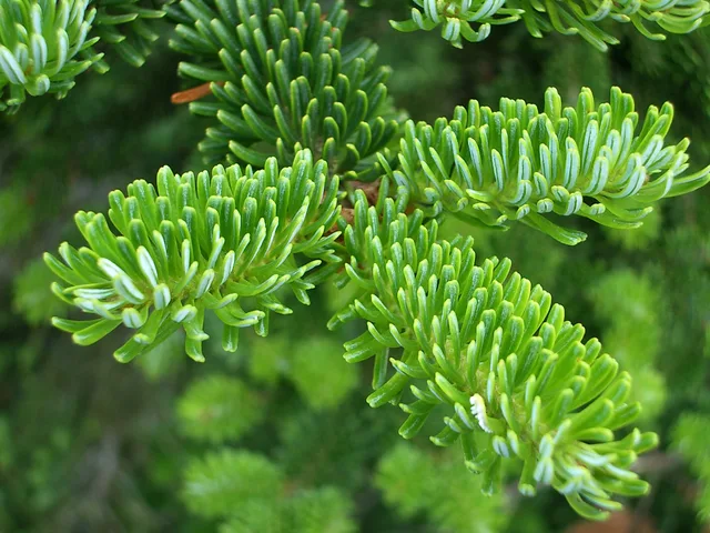
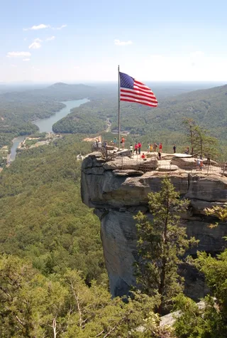
米切爾峰 的影像3 张照片
mindfrieze on Flickr · cc-by-sa-2.0 · 2006年7月18日
Soil-Science.info on Flickr (USDA Natural Resources Conservation Service) · cc-by-2.0 · 2003年11月4日
Tsimmons · cc-by-sa-3.0 · 2007年10月13日

交通与住宿

2 个来源 · 截至 2026年11月3日
来源:TravelHub · OurAirports (public domain)

曾到此处的参与者

Кириллstriklend · 阅读
26) 第8名。大迷雾山脉

早晨,我们继续穿越迷人的 Great Smokies 之旅。道路一直向南延伸。柏油路上铺满了落叶,窗外是连绵起伏的丘陵,天空中挂着太阳。还需要什么呢?) 当然是一张涵盖所有这些绝美景色的地图!) 我们在路边的游客中心拿了一张,并标记了必去的地方。 很快就到了第一个景点——我们来到了 Linville falls 瀑布群。它距离公路只有一公里。我们沿着风景优美的步道向上走,我很喜欢,但穿着人字拖的姑娘们就不太开心了。)) 顺便说一下,这是我们在美国看到的第一个瀑布=) 轰鸣声、水花,还可以爬到瀑布源头的湖边。太棒了!) 接着我们驶过了世界上最复杂的混凝土桥——Linn Cove Viaduct,高度在地面上方一百多米。两侧空荡荡的——飞行感被不能下车驻足的遗憾稍稍破坏了。在这里以及之后,你就会明白为什么这条路被称为 Blue Ridge Parkway。这里的山脉确实是蓝色的。 当你向远处望去,近处的山峰因为树木而呈现绿色,远一点的因为阴影和轻雾而颜色稍深,再远一点的更深更蓝,就这样一直延续下去,直到它们在地平线处几乎与天空融为一体。正因如此,这些山脉被称为“烟雾山”。视野极其开阔,远处的山脊总是笼罩在蓝色的薄雾中... 好了,言归正传,接下来是阿巴拉契亚山脉的最高峰——Mount Mitchell。由于我们爬得更高,之前似乎悬挂在最高峰附近的云层现在将我们完全笼罩。植被发生了剧烈变化。覆盆子、桦树、苔藓——是不是很眼熟?) 感觉就像八月下旬在列宁格勒州开车一样。虽然还没有变黄,但花期早已过去.. 明显的凉意袭来。 在山顶,晴天时可以同时看到两个邻近的州。我们很幸运,看到了半边天的阳光。后来云层飞来,把一切都吞没了。) 这里的云可以用手触摸,它们不会受到任何伤害。它们在山顶徘徊,时而遮住刚刚展现出的绝佳美景。当天空晴朗时,下方的云层让你分不清身在何处。仿佛在飞机上,又仿佛在地面。我想视野能达到250公里。很远。而蓝天下的白云却显得格外近。就是这样。) 只是讨厌的蒸汽一直在飞来飞去,怎么赶也赶不走,干扰了观景,还把人从观景台上赶走。)) 算了。我们吃着覆盆子,回到车里。 接下来我们走走停停,没完没了。到处都是草地、小溪,无论在哪里下车都很棒。然而,我想要一些更宏大的东西。Great Smokies 有很多很酷的岩石——我不记得名字了,但类似 Stone Mountain、Father Mountain 等等。我们决定去 Olya 的妹妹去过的 Chimney Rock。看照片那里很棒) 照片没有骗人。一块巨大的、确实像烟囱一样的岩石耸立在下方的湖泊之上。岩石顶部是平的,所以它也是一个绝佳的观景台。公园下午5点半关门,晚了就不让进了,所以要算好时间) 我们迟到了半小时,不得不满足于从低70米处观看。依然很棒,但上面显然更酷。我们继续前行。窗外天色暗得很快,看来我们对阿巴拉契亚的探索结束了。我们一致希望秋天能再来这里,因为我们有充分的理由认为,很难想象还有比秋天这里更美的地方了。 现在是3天的路程...

  • Кирилл 发布帖子的照片
  • Кирилл 发布帖子的照片
  • Кирилл 发布帖子的照片+2
0关于 米切爾峰 的 0 篇参与者帖子 — 从住宿、签证到周末路线。阅读全部