跳转至内容
TravelHub
莫斯科 · 俄罗斯

花园环路: 周边有什么、如何前往、何时最合适 · 2026年

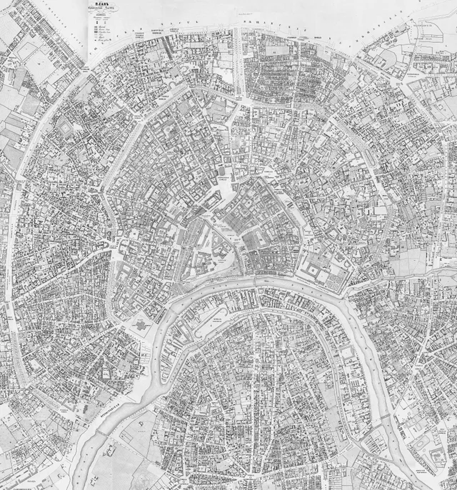
Living inside the circular avenue turns the historic rampart line into your primary compass for navigating downtown transit routes.

地点地图
关于此地

The ring traces historical earthen fortifications that evolved into broad downtown boulevards.

The thoroughfare follows the perimeter of the former Zemlyanoy Gorod ramparts, replacing earlier defensive lines built after sixteenth-century raids. Authorities leveled the earthen barriers to build roads, requiring homeowners to cultivate perimeter foliage. This requirement created tree-lined lanes that gave the corridor its modern identity.

继续阅读

Urban transit adapted across decades as horsecar tracks and electric tram networks took over the circle. The loop still defines central travel patterns, connecting older market zones, ceremonial squares, and administrative hubs across several districts. Residents rely on its continuous line to traverse radial streets without crossing the inner core.
相关组织
  • Earth RampartFortification origins remain preserved in street names along eastern segments.
  • Front GardensMandatory foliage maintenance by residents shaped the wide green boulevards.
  • Heavy TrafficMulti-lane arterial congestion routinely slows surface vehicle travel.
事实信息
  • The avenue aligns with the former seventeenth-century ramparts of Zemlyanoy Gorod.
  • Earthen defensive barriers were demolished during the nineteenth century to open space for roadway construction.
  • Property owners were historically required to plant and tend private garden plots along designated street segments.
  • The circular transport corridor formerly operated electric tram lines and passenger horsecar tracks.
来源:Wikipedia

交通与住宿

房主免费住宿查看所有房主
在市区2,087房主欢迎客人
2 个来源 · 截至 2026年11月3日
来源:TravelHub · OurAirports (public domain)