
Sturgeon Bay: Travel guide, prices and free housing · 2026
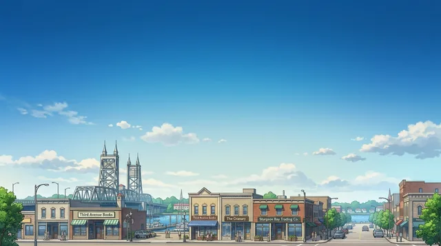
Residents plan daily routines around the drawbridges connecting the eastern and western shores, where open canal bridges pause traffic between the city districts.
- 1 day
- Steel Bridge, Downtown, Ice Age Trail
- 3 days
- + Bay View Park, Ahnapee State Trail, Carlsville
- 7 days
- + Lake Michigan, Ship Canal, Sand Bay, Whitefish Bay
A working maritime corridor defines everyday movement across the bay.
Sturgeon Bay sits halfway up the Door Peninsula where an arm of Green Bay connects to Lake Michigan through a ship canal. Water divides the community into distinct halves linked by movable drawbridges, including the historic Steel Bridge and the Oregon-Maple crossing. Downtown navigation follows distinct street naming patterns, using tree species and city names on the western shore and state names across the water.
Read on
Daily transit around the peninsula relies heavily on private vehicles, with state expressways and county roads connecting to outer bayshore villages. Commercial air travel requires driving to the regional airport in Green Bay. Foot travel remains practical along the downtown waterfront, where paved urban paths connect directly into the Ice Age Trail and the longer Ahnapee State Trail extending south toward neighboring communities.
- Canal Drawbridges
- Ship Canal
- Ahnapee State Trail
- Regional Transit Reliance
- The Sturgeon Bay Ship Canal connects Green Bay waters to Lake Michigan.
- Commercial air service and vehicle rentals operate out of Green Bay rather than the local airfield.
- Urban walkways in the city connect to the Ice Age Trail and the Ahnapee State Trail.
- The Potawatomi name recorded for Sturgeon Bay is Na-ma-we-qui-tong.
Getting there and staying
- 01Connect mobile devices to a domestic cellular network upon arrival.
- 02Withdraw cash from an automated teller machine if needed for local transactions.
- 03Pick up a rental vehicle to travel across the drawbridges into the city.
- 04Check in to your downtown hotel or waterfront lodging.
2 sources · As of November 4, 2026
Visa and practicalities
Choose a passport
Set your passport — processing time, fee and documents differ between passports.
Internships, au pair and study programmes have a different visa category and a different set of documents. Applications go through CMO International Programmes.
IEC international programmesWhere is the nearest commercial airport for flying into the city?
Commercial flights and car rentals operate through Austin Straubel International Airport in Green Bay. Door County Cherryland Airport serves local aviation needs closer to town.
Source: WikivoyageHow does the local waterway connect to the surrounding Great Lakes?
The bay extends into the Door Peninsula from Green Bay. The Sturgeon Bay Ship Canal links the bay directly to Lake Michigan.
Source: WikipediaAre there dedicated walking routes and long-distance hiking trails in town?
Downtown streets provide sidewalks along both sides of the roadway. Pedestrians can access the Ice Age Trail along Madison Avenue and Bay View Park, connecting southward to the Ahnapee State Trail toward Algoma.
Source: WikivoyageHow do vehicles cross the waterway separating the two sides of the city?
Drawbridges maintained by the state cross the water to link both sides of the community. Travelers cross via the historic Steel Bridge on Michigan Street, the Oregon-Maple Street Bridge, or the Bay View Bridge bypass.
Source: WikivoyageGetting here
When to go and itineraries
- 09:00Madison AvenueBegin on the west side with local bakeries and views of the bay.
- 11:30Steel BridgeWalk across the historic drawbridge toward the eastern downtown district.
- 13:30Maritime MuseumTour the exhibits showcasing the local shipbuilding and navigation heritage.
- 16:30Bay View ParkFollow the waterside walking path along the Ice Age Trail corridor.
- 10:00Ahnapee State TrailHike or cycle the regional trail corridor south from the bay.
- 13:00Sturgeon Bay Ship CanalView the waterway connecting the bay to Lake Michigan.
- 16:00CarlsvilleVisit the regional wineries situated north of the city center.
Stay longer on a programme
Work and Travel, internships, au pair and volunteering in United States: visa, invitation and on-site support are handled by CMO International Programmes.

Cities of United States
Countries nearby
Frequent questions about Sturgeon Bay
Can’t find the place you need? Search understands any language. Open search