
Sturgeon Bay: Guía de viajes, precios y alojamiento gratuito · 2026
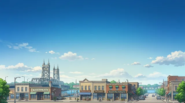
Residents plan daily routines around the drawbridges connecting the eastern and western shores, where open canal bridges pause traffic between the city districts.
- Municipal offices and civic services
- English
- Supper clubs, bakeries, and dining venues
- English
- Waterfront resorts, motels, and rental agencies
- English
«Does the rent include utilities?» — Use when reviewing residential rental agreements with landlords.
- 1 día
- Steel Bridge, Downtown, Ice Age Trail
- 3 días
- + Bay View Park, Ahnapee State Trail, Carlsville
- 7 días
- + Lake Michigan, Ship Canal, Sand Bay, Whitefish Bay
A working maritime corridor defines everyday movement across the bay.
Sturgeon Bay sits halfway up the Door Peninsula where an arm of Green Bay connects to Lake Michigan through a ship canal. Water divides the community into distinct halves linked by movable drawbridges, including the historic Steel Bridge and the Oregon-Maple crossing. Downtown navigation follows distinct street naming patterns, using tree species and city names on the western shore and state names across the water.
Seguir leyendo
Daily transit around the peninsula relies heavily on private vehicles, with state expressways and county roads connecting to outer bayshore villages. Commercial air travel requires driving to the regional airport in Green Bay. Foot travel remains practical along the downtown waterfront, where paved urban paths connect directly into the Ice Age Trail and the longer Ahnapee State Trail extending south toward neighboring communities.
- Canal Drawbridges
- Ship Canal
- Ahnapee State Trail
- Regional Transit Reliance
- The Sturgeon Bay Ship Canal connects Green Bay waters to Lake Michigan.
- Commercial air service and vehicle rentals operate out of Green Bay rather than the local airfield.
- Urban walkways in the city connect to the Ice Age Trail and the Ahnapee State Trail.
- The Potawatomi name recorded for Sturgeon Bay is Na-ma-we-qui-tong.
Cómo llegar y dónde quedarse
- 01Connect mobile devices to a domestic cellular network upon arrival.
- 02Withdraw cash from an automated teller machine if needed for local transactions.
- 03Pick up a rental vehicle to travel across the drawbridges into the city.
- 04Check in to your downtown hotel or waterfront lodging.
2 fuentes · A fecha de 4 de noviembre de 2026
Visado y aspectos prácticos
Elegir un pasaporte
Establece tu pasaporte: el tiempo de procesamiento, la tarifa y los documentos varían según el pasaporte.
Las pasantías, los programas de au pair y de estudio tienen una categoría de visado y un conjunto de documentos diferentes. Las solicitudes se realizan a través de CMO International Programmes.
Programas internacionales IECWhere is the nearest commercial airport for flying into the city?
Commercial flights and car rentals operate through Austin Straubel International Airport in Green Bay. Door County Cherryland Airport serves local aviation needs closer to town.
Fuente: WikivoyageHow does the local waterway connect to the surrounding Great Lakes?
The bay extends into the Door Peninsula from Green Bay. The Sturgeon Bay Ship Canal links the bay directly to Lake Michigan.
Fuente: WikipediaAre there dedicated walking routes and long-distance hiking trails in town?
Downtown streets provide sidewalks along both sides of the roadway. Pedestrians can access the Ice Age Trail along Madison Avenue and Bay View Park, connecting southward to the Ahnapee State Trail toward Algoma.
Fuente: WikivoyageHow do vehicles cross the waterway separating the two sides of the city?
Drawbridges maintained by the state cross the water to link both sides of the community. Travelers cross via the historic Steel Bridge on Michigan Street, the Oregon-Maple Street Bridge, or the Bay View Bridge bypass.
Fuente: WikivoyageCómo llegar
Cuándo ir e itinerarios
- 09:00Madison AvenueBegin on the west side with local bakeries and views of the bay.
- 11:30Steel BridgeWalk across the historic drawbridge toward the eastern downtown district.
- 13:30Maritime MuseumTour the exhibits showcasing the local shipbuilding and navigation heritage.
- 16:30Bay View ParkFollow the waterside walking path along the Ice Age Trail corridor.
- 10:00Ahnapee State TrailHike or cycle the regional trail corridor south from the bay.
- 13:00Sturgeon Bay Ship CanalView the waterway connecting the bay to Lake Michigan.
- 16:00CarlsvilleVisit the regional wineries situated north of the city center.
Idioma y cultura
Cinco frases para el primer día y dónde no puedes prescindir del idioma
English is the sole primary language used for commerce, municipal administration, and daily conversation across the city. Complete fluency ensures full access to local services, housing arrangements, and community interactions.
- Does the rent include utilities?Does the rent include utilities?
- Is the lease month to month?Is the lease month to month?
- Could we split the bill?Could we split the bill?
- Could I get a paper receipt, please?Could I get a paper receipt, please?
- Are there seasonal maintenance fees?Are there seasonal maintenance fees?
| Situación | Idioma |
|---|---|
| Municipal offices and civic services | English |
| Supper clubs, bakeries, and dining venues | English |
| Waterfront resorts, motels, and rental agencies | English |
| Retail establishments and local businesses | English |

Estancia prolongada en un programa
Work and Travel, prácticas, au pair y voluntariado en Estados Unidos: la visa, la invitación y el apoyo en el destino son gestionados por CMO International Programmes.

Ciudades de Estados Unidos
Países cercanos
Preguntas frecuentes sobre Sturgeon Bay
¿No encuentras el lugar que necesitas? La búsqueda entiende cualquier idioma. Abrir búsqueda