

Skip to content
TravelHub
Unwind

Great Yarmouth: Travel guide, prices and free housing · 2026

Locals plan daily travel around lifting river bridges and quickly adopt the habit of checking vessel traffic before heading across town.

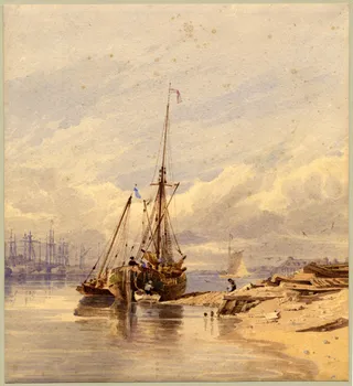
Great Yarmouth · CC BY-SA 4.0

Map of places
Now in the cityGreat Yarmouthsunset 04:20 PM
EntryPick a passportThe answer depends on the passport.
Places on the map10
Exchange rate£0.75per 1 $GBP — the local currencyas of Nov 2, 2026
Language on siteEnglishSpoken language
Loading the map
What fits initineraries
1 day
Marine Parade, Great Yarmouth Minster, Market Place
3 days
Venetian Waterways, Pleasure Beach, Gorleston-on-Sea
7 days
Caister-on-Sea, Hopton on Sea, Burgh Castle
About the place

A maritime harbour rebuilt itself from herring fleets into an offshore energy hub while retaining a vast seaside promenade.

The settlement occupies a strip of land between the river and the open sea, shaping a town where harbour operations and beach tourism exist side by side. Former herring fleets gave way to service vessels supporting offshore gas platforms and North Sea wind turbines. Quaysides once filled with merchant shipping now support renewable energy crews alongside pleasure craft running coastal excursions.

Read on

Everyday life divides between the Golden Mile seafront and the commercial core around the ancient market place. While summer brings crowds to amusement arcades, sandy beaches, and theatre shows on Britannia Pier, winter quiets the promenade significantly. Long-term residents depend on the central market stalls, regular passenger trains along the Wherry Lines, and road links frequently paused by raised river crossings.

Associations
  • Golden MileSeafront strip packed with amusement arcades and sandy beaches.
  • Lifting bridgesRiver crossings raise for vessels, creating road traffic delays.
  • Market chip stallsTraditional food stands operating in the central market square.
  • Offshore wind energyMarine operations base servicing turbines in the North Sea.
  • Britannia PierHistoric coastal pier hosting summer variety theatre performances.
Facts
  • The town stands on a narrow peninsula between the sea and the river channel.
  • Passenger trains link the local terminal directly to Norwich along the Wherry Lines.
  • Offshore wind turbines and gas installations replaced the historical herring fishing industry.
  • Lifting bridges across the river channel can pause vehicular traffic when maritime vessels pass.
Source: Wikipedia · Wikivoyage

Getting there and staying

No free-housing hosts here yet — the nearest city with them:

Paris5,030 hosts · 3 hr 45 min
Step by step on arrival
  1. 01Activate a local UK eSIM or SIM card for continuous mobile data connectivity.
  2. 02Withdraw British Pounds from a bank ATM to pay independent seaside market stalls.
  3. 03Board a regional bus from Market Gates or take a taxi from the railway station to reach lodging.
2 sources · As of November 3, 2026
Source: TravelHub · OurAirports (public domain)

Visa and practicalities

Choose a passport

Set your passport — processing time, fee and documents differ between passports.

Internships, au pair and study programmes have a different visa category and a different set of documents. Applications go through CMO International Programmes.

IEC international programmes
Good to know
  • Parking in designated residential zones on side streets requires an official permit.
  • Lifting bridges across the river raise for maritime traffic and cause road delays.
Frequently asked
How do passenger trains and buses connect to Great Yarmouth?

Great Yarmouth railway station provides direct rail connections to Norwich along the Wherry Lines. Regional bus services run from the transit hub beneath the Market Gates Shopping Centre, providing links to Norwich, Lowestoft, and surrounding coastal villages.

Source: Wikipedia · Wikivoyage
What causes vehicle delays when crossing the local river?

The River Yare divides the town from neighboring communities, funneling road traffic across Haven Bridge, Breydon Bridge, and Herring Bridge. These structures are lifting bridges that raise to let marine vessels pass, creating temporary road congestion.

Source: Wikipedia
What food specialty is found in the main market place?

The historic market square is known for its permanent chip stalls. These open-air kiosks have operated in the central shopping district over multiple generations.

Source: Wikipedia · Wikivoyage
What attractions are situated along the seafront promenade?

Marine Parade features sandy beaches, amusement arcades, Britannia Pier, and Wellington Pier. The surrounding coastal strip also contains the Hippodrome Circus, the restored Venetian Waterways, and seaward views toward Scroby Sands.

Source: Wikipedia
Which long-distance walking routes reach Great Yarmouth?

Footpaths ending in the town include Angles Way, Weavers' Way, and the Cross Norfolk Trail. These trails link the coastal settlement to inland Norfolk and other coastal settlements.

Source: Wikivoyage
Which historic buildings and fortifications survive in the town?

Sections of the medieval town wall stand preserved near the old town and parish cemetery. Other prominent heritage sites include the medieval Tollhouse gaol and Great Yarmouth Minster.

Source: Wikipedia · Wikipedia
2 sources
Source: Wikivoyage · Wikipedia

Safety and health

Safety · official adviceour data as of Nov 3, 2026
US State DepartmentLevel 2Watch your surroundings and belongings more closely than usual.
Full text

Exercise increased caution in the United Kingdom due to  terrorism . There is risk of terrorist violence, including terrorist attacks and other activity in the United Kingdom. Visit the U.S. Department of State's  country reports on terrorism   to learn more. There is also risk of isolated violence by dissident groups in Northern Ireland. These groups mainly target police and military.

Getting here

Getting hereOurAirports (public domain)
Norwich Airport NWI31 km from the centre
London Stansted Airport STN130 km from the centre
London Southend Airport SEN136 km from the centre

When to go and itineraries

Ready-made itineraries
Seafront and Heritage2.2 km on foot
  1. 09:00Great YarmouthStart at the historic market place near the medieval town walls and the Minster.
  2. 12:00Great Yarmouth Pleasure BeachWalk along Marine Parade to see the seaside amusements and coastal gardens.
  3. 15:00Gorleston-on-SeaCross the River Yare to reach the quiet sandy beach and the lifeboat station.
Coastal and Historical Excursions17 km on foot
  1. 10:00Caister-on-SeaTravel north along the coast to explore the beaches and nearby castle grounds.
  2. 13:00Burgh Castle Roman SiteVisit the surviving stone Roman fort camp overlooking the waterways.
  3. 16:00Hopton on SeaHead south along the coast to walk the shoreline paths.

Similar nearby

Can’t find the place you need? Search understands any language. Open search