
- Відстань
- 5,3 км
Сполучені Штати Америки
Великий Каньйон: що навколо, як дістатися і коли їхати · 2026
Grand Canyon Village isolates residents with finite municipal water lines and extreme vertical trail access, forcing long-term personnel to plan every rim-to-river journey around backcountry clearance.
Що навколо59
Курс валюти1,00 $станом на 4 лист. 2026 р.
Що є навколо59
 Музей мистецтва Метрополітен
 Волл-стріт
 Білий дім
 Всесвітній торговий центр
 Бруклінський міст
 Центральний парк
 Емпайр-Стейт-Білдінг
 Золота Брама
 Міжнародний аеропорт імені Джона Кеннеді
 Статуя Свободи
 Пентагон
 Вілліс Тауер
 Бруклінський музей
 Центр Ґетті
 Музей Ґетті
 Музей сучасного мистецтва
 Музей Соломона Ґуґґенгайма
 Bronx Zoo
 Арка Гейтвей
 Сенчурі Лінк Філд
 Мерседес-Бенц Стедіум
 NRG-Стедіум
 Юнайтед-центр
 Бродвей
 Штаб-квартира ООН
 Рокфеллерський центр
 Всесвітній торговий центр 7
 Джон Генкок Центр
 Американський музей природознавства
 Аон центр
 Художній інститут Чикаго
 AT&T стадіон
 Башта Банку Америки
 Верайзон-центр
 Карнегі-хол
 Крайслер Білдінг
 Коні-Айленд (Бруклін)
 Гонолулу
 Діснейленд
 П'ята авеню
 Праска
 Гранд-Сентрал-Стейшн
 Індіанаполіс Мотор Спідвей
 Аеропорт Ла-Гуардія
 Леві Стедіум
 Медісон-сквер-гарден
 Мангеттенський міст
 Новий Амстердам
 Будівля Нью-Йорк Таймс
 Міжнародний аеропорт Ньюарк Ліберті
 Всесвітній торговий центр 1
 Зала слави рок-н-ролу
 Space Needle
 собор Святого Патріка
 Таймс-Сквер
 Трамп-тауер
 Військово-морська Академія США
 Будинок Вулворт
- Акадія
Про місце
Extreme vertical relief defines routine movement across the canyon rim.
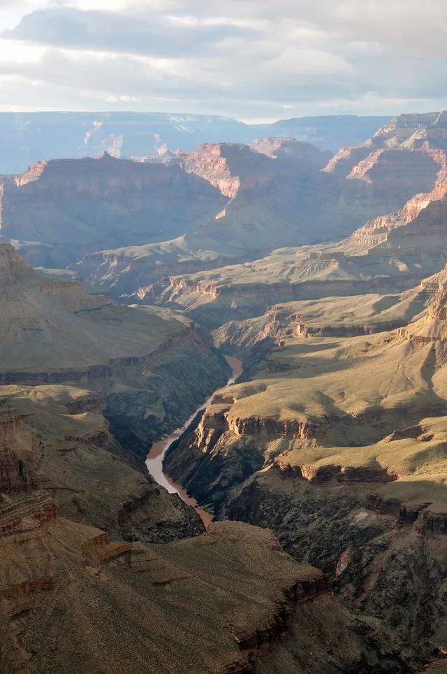
Carved by the Colorado River across northern Arizona, the canyon forms an immense barrier between northern and southern plateaus. Ancestral Puebloan, Cohonina, and Sinagua groups inhabited these cliff environments centuries before Spanish expeditions reached the rim. Today, modern settlements cluster around strict park boundaries and tribal territories.
Читати далі
Daily operations along the populated South Rim run year-round, while high-altitude North Rim access shuts down entirely during winter snowpack. Domestic infrastructure relies heavily on fresh water transported across the gorge from northern springs through an aging pipeline. Resource conservation shapes domestic work as water reserves remain vulnerable.
Hikers face punishing elevation losses on descent that double in difficulty during the return climb under searing canyon heat. Rangers systematically discourage single-day round trips to the river due to regular medical evacuations, requiring wilderness campers to secure competitive permits from backcountry administrators months in advance.
Асоціації
- South Rim
- North Rim
- Heat exhaustion
- Skywalk
Факти
- The Colorado River carved the steep-sided canyon within the borders of Arizona.
- South Rim facilities depend on water pumped through a pipeline running from North Rim springs.
- Park authorities advise against hiking down to the river and back to the rim in a single day.
- Overnight stays below the canyon rim mandate permits issued by the Backcountry Office.
Великий Каньйон у світлинах6 фотографій
Дорога та житло
2 джерела · Станом на 5 листопада 2026 р.
Джерело: TravelHub · OurAirports (public domain)
Схоже поблизу
 ≈ 4 год 5 хв у дорозіЛонґ-Біч
- Місяць
- ≈ 3 067 $
- Відстань
- 614 км
Міста Сполучені Штати Америки
Місця в Великий Каньйон
Країни поруч
Часті питання про Великий Каньйон
Не можете знайти потрібне місце? Пошук розуміє будь-яку мову. Відкрити пошук