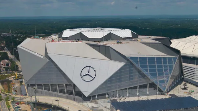
 Мерседес-Бенц Стедіум
- Відстань
- 1 048 км
 TravelHub
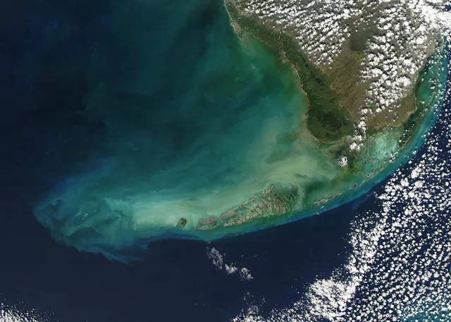
Living on this coral chain ties everyday logistics to a single two-lane roadway, where any severe storm forces complete evacuation back to the mainland.
 Музей мистецтва Метрополітен
 Волл-стріт
 Білий дім
 Всесвітній торговий центр
 Бруклінський міст
 Центральний парк
 Емпайр-Стейт-Білдінг
 Золота Брама
 Міжнародний аеропорт імені Джона Кеннеді
 Статуя Свободи
 Пентагон
 Вілліс Тауер
 Бруклінський музей
 Центр Ґетті
 Музей Ґетті
 Музей сучасного мистецтва
 Музей Соломона Ґуґґенгайма
 Bronx Zoo
 Арка Гейтвей
 Сенчурі Лінк Філд
 Мерседес-Бенц Стедіум
 NRG-Стедіум
 Юнайтед-центр
 Бродвей
 Штаб-квартира ООН
 Рокфеллерський центр
 Всесвітній торговий центр 7
 Джон Генкок Центр
 Американський музей природознавства
 Аон центр
 Художній інститут Чикаго
 AT&T стадіон
 Башта Банку Америки
 Верайзон-центр
 Карнегі-хол
 Крайслер Білдінг
 Коні-Айленд (Бруклін)
 Гонолулу
 Діснейленд
 П'ята авеню
 Праска
 Гранд-Сентрал-Стейшн
 Індіанаполіс Мотор Спідвей
 Аеропорт Ла-Гуардія
 Леві Стедіум
 Медісон-сквер-гарден
 Мангеттенський міст
 Новий Амстердам
 Будівля Нью-Йорк Таймс
 Міжнародний аеропорт Ньюарк Ліберті
 Всесвітній торговий центр 1
 Зала слави рок-н-ролу
 Space Needle
 собор Святого Патріка
 Таймс-Сквер
 Трамп-тауер
 Військово-морська Академія США
 Будинок Вулворт
The islands stretch between the Atlantic Ocean and the Gulf of Mexico, with Key West at the far western settled fringe. Life revolves around water trades and reef diving, but low ground elevation means seasonal tropical cyclones routinely trigger compulsory evacuations back along the causeways to the mainland.
Vehicular access relies on the Overseas Highway, constructed over the footprint of an earlier coastal rail line wrecked by a hurricane. The roadway spans bridges such as Seven Mile Bridge, where older surviving spans remain reserved for pedestrian access while vehicles depend on a narrow corridor subject to heavy collision rates.
Не можете знайти потрібне місце? Пошук розуміє будь-яку мову. Відкрити пошук