
შინაარსზე გადასვლა
TravelHub
Wisconsin Dells · ამერიკის შეერთებული შტატები

Dells of the Wisconsin River: რა არის ირგვლივ, როგორ მივიდეთ და როდის · 2026

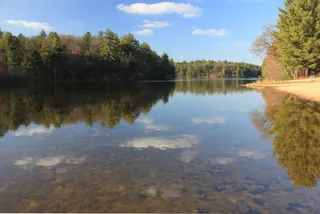
Anyone staying for the season navigates around the Kilbourn Dam, which splits the sandstone gorge into disconnected upper and lower segments with different water levels.

ადგილების რუკა
რა არის ირგვლივ13
გაცვლითი კურსი1,00 $1 $-ზეUSD — ქვეყნის ვალუტა3 ნოე. 2026-ის მდგომარეობით
ადგილის შესახებ

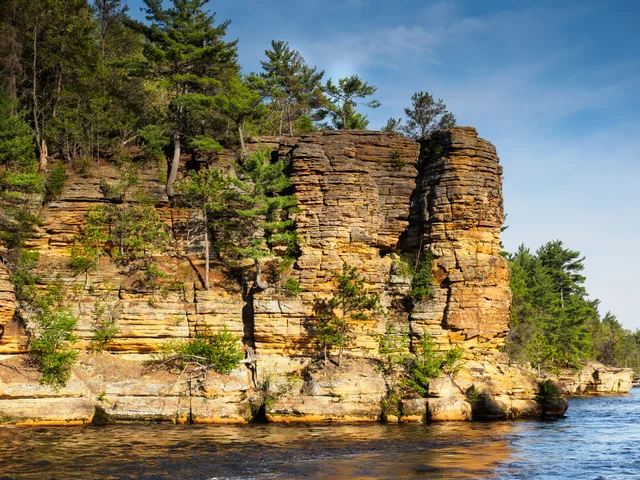
Cambrian sandstone formations frame the river gorge.

The gorge cuts through Cambrian sandstone, producing narrow tributary canyons and layered stone outcrops along the channel. Kilbourn Dam splits the natural formation into distinct upper and lower sections. Upstream, the impoundment permanently lifted the waterline, submerging several sandstone caves and riverbank features that defined the early landscape before hydroelectric development altered the riverbed.

წაიკითხეთ მეტი

Long before commercial tourism, Paleo-Indian groups and Native American nations including the Ho-Chunk, Sac, and Menominee established settlements along these banks. They left behind burial mounds, effigy mounds, rock art, and cultivated garden beds. Landscape photographer H. H. Bennett later drew public attention to the rock towers through innovative stop-action prints, including a famous exposure of a leap onto Stand Rock.

ასოციაციები
  • Kilbourn DamHydroelectric construction severed the gorge and submerged several historic caves.
  • Cambrian SandstoneWater erosion carved layered canyon walls and distinct freestanding rock pillars.
  • Stand RockEarly stop-action photography of a leap onto this pillar popularized the scenery.
  • Effigy and Burial MoundsNative American earthworks and rock carvings remain preserved along the corridor.
ფაქტები
  • Kilbourn Dam divides the gorge into upper and lower segments.
  • Water impoundment from the dam flooded rock formations and caves in the upper gorge.
  • Photographer H. H. Bennett popularized the landscape through stop-action photography at Stand Rock.
  • Early Ho-Chunk, Sac, and Menominee residents left effigy mounds, burial mounds, and rock art in the area.
წყარო: Wikipedia

მგზავრობა და განთავსება

2 წყარო · 4 ნოემბერი, 2026-ის მონაცემებით
წყარო: TravelHub · OurAirports (public domain)

ვერ პოულობთ სასურველ ადგილს? საძიებო სისტემას ნებისმიერი ენის ესმის. ძიების გახსნა