

 ≈ 30 мин жолХалықаралық тырналар қоры
- Қашықтық
- 11 км
 TravelHub
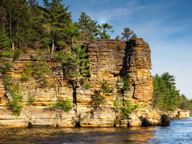
Anyone staying for the season navigates around the Kilbourn Dam, which splits the sandstone gorge into disconnected upper and lower segments with different water levels.
The gorge cuts through Cambrian sandstone, producing narrow tributary canyons and layered stone outcrops along the channel. Kilbourn Dam splits the natural formation into distinct upper and lower sections. Upstream, the impoundment permanently lifted the waterline, submerging several sandstone caves and riverbank features that defined the early landscape before hydroelectric development altered the riverbed.
Long before commercial tourism, Paleo-Indian groups and Native American nations including the Ho-Chunk, Sac, and Menominee established settlements along these banks. They left behind burial mounds, effigy mounds, rock art, and cultivated garden beds. Landscape photographer H. H. Bennett later drew public attention to the rock towers through innovative stop-action prints, including a famous exposure of a leap onto Stand Rock.
≈ 30 мин жолХалықаралық тырналар қорыІздеген жеріңізді таппадыңыз ба? Іздеу жүйесі кез келген тілді түсінеді. Іздеуді ашу