跳转至内容
TravelHub
布萊頓海灘 · 美国

韋拉札諾海峽大橋: 周边有什么、如何前往、何时最合适 · 2026年

Drivers commuting between Brooklyn and Staten Island face the sole vehicular crossing over the Narrows, shaping daily regional road transit.

地点地图
关于此地

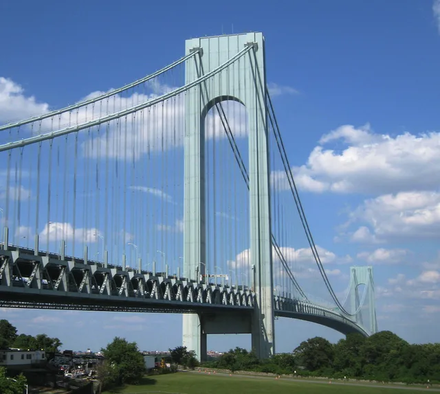
The Verrazzano-Narrows Bridge provides the only physical link across the tidal strait.

The suspension structure joins Brooklyn to Staten Island across the Narrows. It carries Interstate traffic across a double-deck roadbed that handles vehicular movement between the boroughs. The span carries vehicular lanes over both decks to accommodate interstate drivers bypassing Manhattan.

继续阅读

Early proposals for the crossing emerged under the name Liberty Bridge before public officials blocked private development schemes. Alternative blueprints included vehicular tubes and subway tracks from Bay Ridge toward Staten Island, though lack of municipal funding halted initial excavation.

相关组织
  • Interstate 278Carries regional highway traffic directly across the double-deck roadway.
  • The NarrowsConnects New York Harbor to Lower New York Bay and the Atlantic Ocean.
  • Bay Ridge disruptionOriginal bridge construction schemes faced neighborhood opposition over property demolition.
事实信息
  • The span forms the only fixed crossing spanning the Narrows.
  • The bridge carries Interstate 278 across double-deck levels between Brooklyn and Staten Island.
  • Giovanni da Verrazzano entered New York Harbor as an explorer before the span took his name.
  • Fiorello H. La Guardia blocked an early private proposal called the Liberty Bridge.
来源:Wikipedia
韋拉札諾海峽大橋 的影像6 张照片
Laslovarga · cc-by-sa-3.0 · 2007年6月1日
Ronen Perry · cc-by-3.0 · 2006年10月1日
Wusel007 · cc-by-sa-3.0 · 2006年4月5日

交通与住宿

2 个来源 · 截至 2026年11月4日
来源:TravelHub · OurAirports (public domain)

Google 评价

访客在 Google 地图上怎么说

Google 地图的评分和最新评价将按需加载。