

Skip to content
TravelHub
Unwind

Palm Springs: Travel guide, prices and free housing · 2026

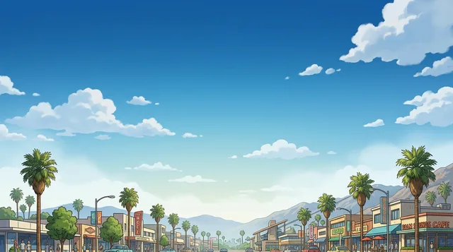
Anyone settling here must navigate checkerboard residential plots leased from the Agua Caliente tribe, while desert summer temperatures force everyday life into early morning hours.

Palm Springs, California · CC BY-SA 4.0

Map of places
Now in the cityPalm Springs+21°CClear · sunset 04:52 PMupdated 08:28 AM
EntryPick a passportThe answer depends on the passport.
Places on the map3
Exchange rate$1.00per 1 $USD — the local currencyas of Nov 2, 2026
Language on siteEnglishSpoken language
Loading the map
What fits initineraries
1 day
Palm Canyon Drive, Aerial Tramway, La Plaza
3 days
+ Andreas Canyon, Tahquitz Canyon, Plaza Theatre
7 days
+ San Jacinto Wilderness, Desert Art Center, Palm Canyon
About the place

Palm Springs balances modernist architecture against ancestral tribal territory in the Coachella Valley.

The urban layout follows a checkerboard grid split between municipal parcels and Agua Caliente Band of Cahuilla Indians reservation plots. Because the tribe remains the largest landowner within city limits, many residential and commercial properties operate on long-term ground leases rather than standard fee-simple deeds. These lease agreements directly shape local property transactions, building permits, and long-term residency.

Read on

Desert modernism defines the residential neighborhoods, where post-war architects adapted clean geometric lines to arid surroundings with deep overhangs and native stone. Local preservation groups maintain strict oversight on alterations to historic structures. The calendar revolves around winter events such as the Palm Springs International Film Festival and Modernism Week, which fill hotels and double downtown foot traffic.

Daily life shifts dramatically between seasons. Extreme summer heat empties streets and concentrates activity indoors, while winter brings high hotel occupancy and heavy traffic along the one-way corridors of Palm Canyon Drive and Indian Canyon Drive. Cycling is practical only during cooler months. While SunLine buses link neighboring communities across the Coachella Valley, personal vehicles remain necessary for regular errands.

Associations
  • Mid-century modernismHistoric desert architecture subject to strict preservation rules.
  • Agua Caliente BandThe sovereign tribe owns extensive checkerboard sections of the city.
  • Summer desert heatHigh temperatures halt daytime outdoor activity for several months.
  • Palm Springs Aerial TramwayRotating cars transport passengers from the desert floor up into wilderness.
Facts
  • The Agua Caliente Band of Cahuilla Indians holds more land within city boundaries than any other owner.
  • Rotating cable cars on the Palm Springs Aerial Tramway carry passengers from Chino Canyon to the San Jacinto Wilderness.
  • Downtown thoroughfares follow single-direction paths, with Palm Canyon Drive carrying southbound traffic and Indian Canyon Drive running north.
  • Local public transport is managed by SunLine Transit, linking the community with neighboring resort settlements.
Source: Wikipedia · Wikivoyage
Palm Springs in pictures19 photos
Clarisse Meyer clarissemeyer · cc0 · Dec 8, 2016
Samantha Sophia samanthasophia · cc0 · Jan 31, 2017
Kai Gradert kai · cc0 · Apr 4, 2017
Patrick Nouhailler · cc-by-sa-2.0 · Jan 2, 2010

Getting there and staying

Step by step on arrival
  1. 01Connect to the terminal wireless internet network upon landing at the airport.
  2. 02Obtain United States currency from a terminal automated teller machine.
  3. 03Board the local SunLine transit bus at Tahquitz Canyon Way or pick up a rental vehicle.
  4. 04Check in at your reserved hotel or rental accommodations in the central district.
2 sources · As of November 3, 2026
Source: TravelHub · OurAirports (public domain)

Visa and practicalities

Choose a passport

Set your passport — processing time, fee and documents differ between passports.

Internships, au pair and study programmes have a different visa category and a different set of documents. Applications go through CMO International Programmes.

IEC international programmes
Good to know
  • Main downtown thoroughfares between Alejo and Ramon operate as directional corridors, with Palm Canyon Drive carrying southbound traffic and Indian Canyon Drive running northbound.
  • City-owned parking lots and garages do not offer complimentary parking on Thursday through Saturday nights.
  • The Amtrak stop is an uncovered platform without a depot building, car rental shuttles, or connecting local public transit.
1 more rule
  • FlixBus operates the sole direct intercity coach connection into downtown Palm Springs, while other long-distance motorcoach carriers terminate in Indio.
Frequently asked
How do travelers reach downtown Palm Springs from the airport?

Palm Springs International Airport sits adjacent to the city center and connects directly to regional destinations. Public buses link the airport perimeter with downtown, while car rental counters operate on the terminal grounds. Travelers can also take commercial taxis or private shuttles directly to their accommodations.

Source: Wikivoyage
How can visitors travel around Palm Springs without a car?

The downtown core along Palm Canyon Drive and Indian Canyon Drive is pedestrian friendly and lined with dining and retail destinations. SunLine Transit operates regular bus routes connecting central districts with neighboring valley communities. Flat local terrain also makes bicycle travel practical during cooler periods of the year.

Source: Wikivoyage
Why is Palm Springs known for its architecture?

The city features an extensive collection of Desert Modern structures designed by prominent architects. Preservation groups actively safeguard historic commercial properties, civic sites, and residential neighborhoods. Architectural tours, exhibitions, and lectures take place during local design festivals such as Modernism Week.

Source: Wikipedia
What outdoor excursions start within the city limits?

The Palm Springs Aerial Tramway transports passengers up Chino Canyon into the alpine wilderness of Mount San Jacinto. Travelers can also explore preserved canyons containing indigenous pictographs, historic irrigation networks, and native fan palm oases. These protected canyons provide hiking routes across varied desert and mountain elevations.

Source: Wikipedia · Wikipedia
What role does tribal land play in Palm Springs?

Palm Springs overlaps extensively with the Agua Caliente Band of Cahuilla Indians reservation, which forms a checkerboard layout across the municipality. The Cahuilla established long-term desert settlements around the area's natural hot springs and maintain large landholdings today. Major downtown avenues and surrounding canyons bear the surnames of historic tribal leaders.

Source: Wikipedia · Wikipedia
2 sources
Source: Wikivoyage · Wikivoyage

Getting here

Getting hereOurAirports (public domain)
Palm Springs International Airport PSP3.5 km from the centre
San Bernardino International Airport SBD70 km from the centre
Ontario International Airport ONT101 km from the centre

When to go and itineraries

Ready-made itineraries
Downtown Architecture and Chino Canyon4 stops
  1. 09:00Palm Canyon DriveWalk the central corridor to observe mid-century modern buildings, art galleries, and palm-lined storefronts.
  2. 11:30La PlazaExplore the historic open-air shopping center downtown and stop at nearby local dining establishments.
  3. 14:00Palm Springs Aerial TramwayBoard rotating tramcars ascending through Chino Canyon to reach mountain viewing platforms and wilderness trailheads.
  4. 17:30San Jacinto WildernessWalk upper mountain paths above the valley floor to experience cooler temperatures and panoramic desert views.
Desert Canyons and Tribal Heritage4 stops
  1. 09:00Tahquitz CanyonHike through the canyon to examine ancient Native American petroglyphs and native desert plant communities.
  2. 12:00Andreas CanyonFollow the creek trail beneath native California fan palms to inspect historical bedrock mortar holes and pictographs.
  3. 15:00Agua Caliente Cultural MuseumInspect cultural exhibits downtown dedicated to the history and traditions of the Agua Caliente Band of Cahuilla Indians.
  4. 18:00Plaza TheatreVisit the historic theater district downtown near local restaurants and evening entertainment venues.

Similar nearby

Can’t find the place you need? Search understands any language. Open search