
Baton Rouge: Travel guide, prices and free housing · 2026
New residents quickly adapt to the severe highway gridlock at the interstate interchange, which makes daily crosstown commuting far slower than the modest city size suggests.
- 1 day
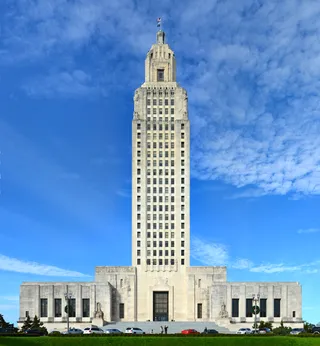
- Capitol Park, Pentagon Barracks, Shaw Center
- 3 days
- + LSU Campus, Mid-City, Perkins Road
- 7 days
- + Scott's Bluff, Perkins Rowe, Denham Springs
Baton Rouge operates as Louisiana's political capital and a major industrial hub along the Mississippi.
State government and heavy industry define the urban structure. The state consolidated its administrative branches downtown at the Capitol Park complex, making public administration a major employer. Along the river, industrial terminals serve as the farthest inland port accessible to ocean-going tankers, transferring cargo onto pipelines, rail lines, and barges. Petrochemical plants form the industrial core.
Read on
University life heavily influences daily rhythms. Campuses including Louisiana State University and Southern University shape local demographics and neighborhood commerce. The local culture blends Cajun and Creole Catholic traditions with African American Baptist roots. For residents, everyday life requires coping with severe highway congestion at the interstate split, while local municipal rules outlaw bar drink specials.
- Louisiana State University
- Highway congestion
- Petrochemical refining
- Inland river port
- Bar drink restrictions
- State government branches are consolidated downtown at the Capitol Park complex.
- Baton Rouge operates the farthest inland port on the Mississippi River capable of handling ocean tankers.
- The municipal council bans promotional drink specials at local bars.
- The city serves as the parish seat for East Baton Rouge Parish.
Getting there and staying
- 01Connect to the terminal Wi-Fi network at the airport or activate an electronic SIM profile for cellular data.
- 02Obtain local currency banknotes from an airport ATM or prepare payment cards for initial expenses.
- 03Proceed to the ground transportation zone outside the terminal to board a municipal bus or meet a rideshare driver.
- 04Check in at your reserved accommodation and secure room access credentials.
2 sources · As of November 3, 2026
Visa and practicalities
Choose a passport
Set your passport — processing time, fee and documents differ between passports.
Internships, au pair and study programmes have a different visa category and a different set of documents. Applications go through CMO International Programmes.
IEC international programmes- Establishments classified as bars operate under municipal regulations that prohibit discounted drink specials.
- Patrons must carry valid identification when visiting drinking establishments because staff verify customer age.
- Purchases made within designated cultural districts qualify for an exemption from state sales tax.
Does Baton Rouge have direct passenger train service?
Baton Rouge lacks direct Amtrak passenger train service. Travelers arriving by rail transfer to connecting buses that run between the city and New Orleans.
Source: WikivoyageWhich airport serves commercial flights to Baton Rouge?
Baton Rouge Metropolitan Airport handles commercial flights in the northern part of the city. Major network carriers connect the terminal to regional hubs including Atlanta, Charlotte, Dallas, and Houston.
Source: WikivoyageWhat public transit is available for getting around Baton Rouge?
Capital Area Transit System operates local bus routes across the city and surrounding areas. Regional and long-distance bus operators run services from designated stations downtown.
Source: WikivoyageWhat industries drive the economy of Baton Rouge?
Petrochemical manufacturing forms the largest commercial sector in the city, anchored by major refining operations along the Mississippi River. State government administration, higher education institutions, and clinical research facilities also serve as major employers.
Source: WikipediaHow did Baton Rouge receive its name?
French explorers encountered a painted red marker along the Mississippi River that designated the territorial boundary between local Indigenous nations. The French translation of that red pole gave the settlement its name.
Source: WikipediaWhat cultural traditions define Baton Rouge?
The local culture blends Cajun and Creole Catholic traditions with regional African American Baptist influences. Several universities foster a large student community, accompanied by established Hispanic and Vietnamese populations.
Source: WikipediaCan ocean-going cargo vessels travel north of Baton Rouge on the Mississippi River?
Baton Rouge marks the inland limit on the Mississippi River for ocean-going cargo vessels and tankers. Upstream navigation past the city is blocked by reduced river depth and low bridge clearance, requiring cargo to be transferred to river barges, pipelines, or rail lines.
Source: Wikipedia2 sources
Getting here
When to go and itineraries
- 09:00Louisiana State CapitolExamine the state government headquarters and the grounds of the Capitol Park complex.
- 11:00Pentagon BarracksWalk the historic barracks grounds adjacent to the capitol park.
- 13:00Louisiana Art and Science MuseumView art collections, space exhibitions, and the Irene W. Pennington Planetarium on River Road.
- 16:00Shaw Center for the ArtsBrowse galleries and finish with rooftop dining overlooking the Mississippi River.
- 10:00Louisiana State University CampusWalk through the main campus grounds and visit the Reilly Theater complex.
- 12:30The ChimesStop for lunch near the north gates of the university campus on Highland Road.
- 15:00Perkins Road Arts DistrictExplore neighborhood shops and local art galleries along Perkins Road.
- 18:00Mid-City Cultural DistrictSpend the evening sampling regional food in the Mid-City dining district.
Stay longer on a programme
Work and Travel, internships, au pair and volunteering in United States: visa, invitation and on-site support are handled by CMO International Programmes.

Cities of United States
Places in Baton Rouge
Countries nearby
Frequent questions about Baton Rouge
Can’t find the place you need? Search understands any language. Open search