


Skip to content
TravelHub
Settle

Alameda: Travel guide, prices and free housing · 2026

Residents here schedule mainland commutes around ferry timetables and bridge traffic, while managing everyday errands along flat neighborhood streets.

Alameda, California · CC BY-SA 4.0

Map of places
Now in the cityAlameda+13°CCloudy · sunset 05:08 PMupdated 08:26 AM
EntryPick a passportThe answer depends on the passport.
Places on the map20
Exchange rate$1.00per 1 $USD — the local currencyas of Nov 2, 2026
Language on siteEnglishPrimary language
What fits initineraries
1 day
Park Street, Alameda Point, Central Avenue
3 days
+ Webster Street, Bay Farm Island, Marina Village
7 days
+ Harbor Bay, Oakland Estuary, Main Street
About the place

Alameda functions as an island community surrounded by the estuary and the bay, relying on bridges and ferries for every mainland connection.

Alameda operates as a distinct island defined by the Oakland estuary to the north and San Francisco Bay to the south. Mainland road traffic enters through eastern bridges or the Posey Tube, an underwater tunnel with an unpleasant pedestrian path. Commuters frequently bypass roadway gridlock by boarding ferries at Main Street, Alameda Seaplane, or Harbor Bay, while a complimentary water shuttle crosses directly to Oakland.

Read on

Daily transit across the interior favors bicycles and foot travel thanks to level terrain, continuous sidewalks, and protected bike lanes. The western shore at Alameda Point occupies a decommissioned naval air station that now hosts craft breweries and open industrial lots. Further inland, commercial activity concentrates along corridors like Park Street and Webster Street, where long-standing local diners sit beside neighborhood taprooms.

Associations
  • San Francisco Bay FerryFerries connect multiple island terminals directly to mainland transit hubs.
  • Posey TubeThe tunnel walkway exposes pedestrians to severe vehicle noise and exhaust.
  • Alameda PointThe former naval air station provides industrial space for craft breweries.
  • Park StreetThe commercial strip anchors island dining with historic diners and cafes.
  • Protected bike routesDedicated cycling infrastructure makes cross-island travel safe and simple.
Facts
  • A complimentary water shuttle links Alameda to Jack London Square in Oakland.
  • The western end of the island encompasses the grounds of a former naval air station.
  • Continuous sidewalks line every street across the island city.
  • Passenger ferries serve multiple separate terminal docks situated across the island.
Source: Wikivoyage
Alameda in pictures9 photos
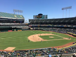
Sanfranman59 · cc-by-sa-3.0 · Oct 4, 2008
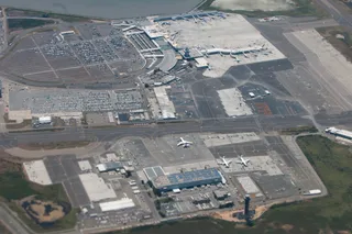
Eugene Zelenko · cc-by-sa-4.0 · Jul 7, 2010

Getting there and staying

Step by step on arrival
  1. 01Arrive at Oakland International Airport and connect to terminal data networks.
  2. 02Withdraw United States currency from an airport cash machine.
  3. 03Board an AC Transit bus or take a taxi to cross onto the island.
  4. 04Check in at your reserved island accommodation.
2 sources · As of November 3, 2026
Source: TravelHub · OurAirports (public domain)

Visa and practicalities

Choose a passport

Set your passport — processing time, fee and documents differ between passports.

Internships, au pair and study programmes have a different visa category and a different set of documents. Applications go through CMO International Programmes.

IEC international programmes
Good to know
  • Pedestrian travel from Oakland through the Posey Tube tunnel is discouraged due to vehicle noise and exhaust.
  • Ferry connections between Harbor Bay and Main Street operate exclusively during rush hour.
  • Bicycles are permitted aboard the water shuttle connecting Alameda and Jack London Square.
Frequently asked
How do you get to Alameda from Oakland International Airport?

Oakland International Airport sits adjacent to Alameda and offers convenient access. Travelers can reach the island by local AC Transit buses or taxis. Certain Oakland and Alameda hotels also operate complimentary airport shuttle services.

Source: Wikivoyage
Is there ferry service connecting Alameda to San Francisco and Oakland?

The San Francisco Bay Ferry operates routes connecting Alameda with destinations across the bay. Terminal docks are located at Main Street, Alameda Seaplane, and Harbor Bay. Additionally, a complimentary water shuttle connects Alameda with Jack London Square in Oakland.

Source: Wikivoyage
Can you walk or ride a bicycle between Oakland and Alameda?

Cyclists and pedestrians can cross bridges equipped with sidewalks or take the local water shuttle from Jack London Square. The Posey Tube contains a pedestrian walkway, but heavy vehicle traffic and exhaust fumes make it unpleasant. The water shuttle accommodates bicycles for the crossing.

Source: Wikivoyage
Does Amtrak train service run directly to Alameda?

Passenger rail services do not enter Alameda directly. Travelers arriving on regional and long-distance trains disembark at stations in Oakland or Emeryville. Connecting public bus lines link those rail stations to the island.

Source: Wikivoyage
How do you get around Alameda without a car?

AC Transit operates bus routes across the island, including late-night service and commuter shuttles. Walking is straightforward because accessible sidewalks line local streets. The island also accommodates bicycling with protected paths, designated lanes, and bicycle parking near businesses.

Source: Wikivoyage
Is Alameda an island?

Alameda is an island separated from the mainland by the Oakland estuary on the north side and bordered by San Francisco Bay to the south. Bridges connect the primary island to Oakland and to Bay Farm Island. Alameda Point occupies the western end of the island on the grounds of a former naval air station.

Source: Wikivoyage
Can you travel between Alameda ferry terminals by water?

Commuters can travel between the Harbor Bay terminal area and the Main Street terminal area by ferry. This water route provides a quicker connection between the locations than traveling by bus during peak commute hours.

Source: Wikivoyage
2 sources
Source: Wikivoyage · Wikivoyage

Getting here

Getting hereOurAirports (public domain)
Oakland San Francisco Bay Airport OAK6.6 km from the centre
San Francisco International Airport SFO20 km from the centre
San Carlos Airport SQL29 km from the centre

When to go and itineraries

Ready-made itineraries
Park Street to Alameda Point5 stops
  1. 09:00Julie's Coffee and Tea GardenHave morning tea and pastries in the outdoor garden.
  2. 11:30Park StreetWalk through the central district of historic storefronts and local shops.
  3. 13:30Ole's Waffle ShopStop for classic American diner fare.
  4. 15:30Alameda PointExplore the former naval base grounds on the western tip of the island.
  5. 17:30Faction BrewingSample local drinks on the patio facing the bay.
West End and Estuary Trail4 stops
  1. 10:00Webster StreetBegin along the western business corridor lined with regional restaurants.
  2. 12:30Phnom Penh HouseHave lunch featuring traditional Cambodian dishes.
  3. 14:30Alameda-Oakland Water ShuttleBoard the free water shuttle across the estuary with a bicycle.
  4. 17:00Forbidden Island Tiki LoungeOrder tropical drinks in a vintage lounge setting.

Similar nearby

Can’t find the place you need? Search understands any language. Open search