Przejdź do treści
TravelHub
Bandar Seri Begawan · Brunei

Kampong Ayer: co jest w pobliżu, jak dojechać i kiedy jechać · 2026

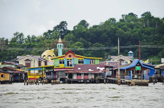
Residents commute across open water by boat and walk elevated wooden boardwalks daily, trading dry-land road access for life on tall timber pilings.

Mapa miejsc
Teraz w mieścieKampong Ayer+27 st. CPochmurnozaktualizowano 19:32W pobliżu1
Kurs waluty1,28 $za 1 $BND — waluta krajustan na 3 lis 2026
O miejscu

A continuous water settlement stands directly on the river opposite the capital center.

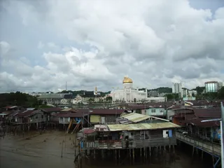
The settlement functions as a self-contained river district where homes, schools, and mosques stand on tall wooden pillars over saltwater. Historical records from European explorers document its heritage as an empire port and commercial trade hub, earning it the moniker Venice of the East. Daily routines depend entirely on elevated plank walkways and water taxis that connect the stilt platforms to the downtown center.

Czytaj dalej

Early structures were assembled on light piles so that families could dismantle and shift dwellings across the river when violent storms threatened. Colonial authorities introduced resettlement programmes to move households onto dry ground, yet generations of residents chose to remain over the riverbed. Modern long-term occupants face constant timber maintenance and tidal dampness while retaining immediate water transit.

Stowarzyszenia
  • Stilt architectureHouses, schools, and mosques rest on wooden pilings over tidal river water.
  • Venice of the EastForeign explorers recorded the vast waterborne settlement across centuries.
  • Storm vulnerabilitySevere river gales historically forced families to move entire wooden houses.
  • Land resettlementGovernment programmes relocated many water households to dry-land districts.
Fakty
  • Neighborhoods containing residences, schools, and places of worship are constructed on stilts over river water.
  • The settlement served as the primary commercial export port during the historical Bruneian Empire.
  • European expedition chroniclers documented the water settlement during early voyages to the region.
  • The community remained inhabited on water despite state initiatives urging relocation to dry land.
Źródło: Wikipedia
Kampong Ayer na zdjęciach8 zdjęć
Balou46 · cc-by-sa-3.0 · 28 lut 2013
JKT-c · cc-by-3.0 · 31 sty 2009
DeltaSquad833 · cc-by-sa-4.0 · 30 sty 2022
Yu Chu Chin · cc-by-sa-4.0 · 24 gru 2022

Dojazd i zakwaterowanie

2 źródła · Stan na 4 listopada 2026
Źródło: TravelHub · OurAirports (public domain)