

- दूरी
- 11 कि॰मी॰
Lake Placid · संयुक्त राज्य
Whiteface Mountain: आसपास क्या है, कैसे पहुँचें और कब जाएँ · 2026
Living at the base of this peak means planning daily routines around sudden alpine freezes, heavy cloud cover, and rapid summit wind shifts.
आसपास8
विनिमय दर$1.002 नव॰ 2026 के अनुसार
स्थान के बारे में
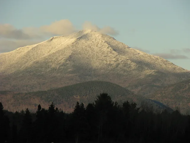
Whiteface Mountain dominates the northern Adirondack skyline as an isolated alpine ridge exposed to extreme weather systems.
Standing apart from the main cluster of the Adirondack High Peaks, Whiteface provides sweeping summit views extending toward Vermont and Canada. Its physical separation creates unobstructed sightlines across regional borders, making the peak a prominent destination for regional hikers and visitors based in nearby Wilmington.
आगे पढ़ें
The summit ridge experiences persistent westerly gales, deep annual snowpacks, and severe subzero temperature drops during midwinter cold snaps. These harsh conditions make summit recreation demanding, requiring continuous trail grooming and supplemental snowmaking across the ski terrain throughout the operating season.
Because the upper elevations frequently sit directly inside cloud decks, the mountain functions as a permanent high-altitude atmospheric monitoring station. Scientists collect continuous meteorological and chemical samples from dedicated base and summit installations to analyze regional air quality, fog droplets, and smoke plumes.
संस्थाएं
- Veterans Memorial Highway
- Atmospheric research
- Severe wind exposure
तथ्य
- Surveyor John Richards completed the earliest recorded climb of the mountain.
- The mountain stands detached from most other Adirondack High Peaks, allowing long-distance views toward Canada.
- University researchers maintain fixed atmospheric monitoring laboratories at the base and summit.
तस्वीरों में Whiteface Mountain7 फोटो
वहाँ पहुँचना और रुकना
2 स्रोत · 4 नवंबर 2026 के अनुसार
स्रोत: TravelHub · OurAirports (public domain)
Google समीक्षाएँ
Google Maps पर आगंतुक क्या लिखते हैं
Google Maps की रेटिंग और हाल की समीक्षाएँ माँगने पर लोड होंगी।
आस-पास के समान विकल्प
- दूरी
- 11 कि॰मी॰
- दूरी
- 11 कि॰मी॰
संयुक्त राज्य के शहर
Whiteface Mountain में जगहें
आस-पास के देश
Whiteface Mountain के बारे में अक्सर पूछे जाने वाले सवाल
अपनी पसंद की जगह नहीं मिल रही? खोज टूल किसी भी भाषा को समझता है। खोज खोलें