Saltar al contenido
TravelHub
Vive

Monterrey: Guía de viajes, precios y alojamiento gratuito · 2026

Residents trade late-night convenience for thick coastal fog and sea lions barking off the harbor breakwater.

Monterey, California · CC BY-SA 4.0

Mapa de lugares
Ahora en la ciudadMonterreyatardecer 17:09
EntradaElige un pasaporteLa respuesta depende del pasaporte.
Lugares en el mapa14
Tipo de cambio1,00 $por 1 $USD — la moneda del paísa fecha de 2 nov 2026
Idioma localEnglishOfficial language
Idioma en el destinofrases
Downtown Monterey
English

«Are utilities included in the rent?» — Use when inspecting an apartment or discussing lease terms with a landlord.

Qué incluyeitinerarios
1 día
Cannery Row, Monterey Bay Aquarium, San Carlos State Beach
3 días
+ Colton Hall, Cooper Molera Adobe, Lake El Estero
7 días
+ Presidio, Robert Louis Stevenson House, Point Lobos
Sobre el lugar

Monterey is a working coastal settlement defined by deep ocean science, preserved adobe architecture, and commercial canning history.

The city sits beside a massive submarine trench that allows researchers and scuba divers direct access to deep Pacific ecosystems close to the harbor shoreline. Kelp forests shelter sea otters and harbor seals along San Carlos Beach, anchoring institutions such as Hopkins Marine Station alongside military research centers. Long-term residents adapt to persistent marine fog and quiet waterfront evenings.

Seguir leyendo

Cannery Row traces the collapse of industrial sardine packing, having shifted from seaside factories to an entertainment district anchored by Monterey Bay Aquarium on the old Hovden Cannery grounds. Away from the waterfront shops, Spanish and Mexican heritage survives in preserved adobe landmarks like Colton Hall and Cooper Molera Adobe. New arrivals find a compact community where historic preservation shapes civic zoning.

Asociaciones
  • Cannery RowFormer sardine packing district transformed into a tourist corridor.
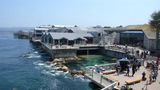
  • Monterey Bay AquariumBuilt inside a converted cannery to display regional marine wildlife.
  • Historic AdobesPreserved buildings like Colton Hall reflect early territorial government.
  • Tourist CongestionSeasonal visitor crowds and tour buses regularly clog the waterfront avenues.
  • Kelp ForestsDense coastal kelp beds provide regular scuba diving and marine research sites.
Datos
  • The Monterey Canyon provides oceanographic researchers with deep-water marine access directly off the bay.
  • The Monterey Bay Aquarium was constructed over the former processing facility of the Hovden Cannery.
  • Spanish expeditions established the local presidio alongside the Cathedral of San Carlos Borromeo.
  • San Carlos State Beach serves as a regular shore entry point for regional scuba diving training.
Fuente: Wikipedia
Monterrey en imágenes8 fotos · 1 lugar
Smatprt · pdm · 1 sept 2009
acuario de la bahía de Monterrey
Thomson20192 · cc0 · 5 jul 2015
acuario de la bahía de Monterrey
Thomson20192 · cc0 · 5 jul 2015
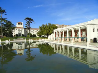
Toi Moi from au bord de la mer Méditerranée, France · cc-by-sa-2.0 · 29 sept 2010

Cómo llegar y dónde quedarse

Paso a paso al llegar
  1. 01Connect personal devices to cellular coverage or airport wireless data upon arrival.
  2. 02Obtain national paper currency from terminal automated teller machines for minor cash needs.
  3. 03Board local public transit or take a taxi from the terminal to reach central accommodation.
2 fuentes · A fecha de 3 de noviembre de 2026
Fuente: TravelHub · OurAirports (public domain)

Visado y aspectos prácticos

Elegir un pasaporte

Establece tu pasaporte: el tiempo de procesamiento, la tarifa y los documentos varían según el pasaporte.

Las pasantías, los programas de au pair y de estudio tienen una categoría de visado y un conjunto de documentos diferentes. Las solicitudes se realizan a través de CMO International Programmes.

Programas internacionales IEC
Preguntas frecuentes
What is Cannery Row and what can visitors find there?

Cannery Row is an oceanfront district named after the John Steinbeck novel that previously housed industrial sardine packing plants. Today it functions as a primary destination featuring converted factory buildings, shops, and the Monterey Bay Aquarium. Seasonal heritage trolleys run between the neighborhood and the downtown area.

Fuente: Wikipedia
Where can visitors observe local marine life and go diving?

Divers enter the water at San Carlos State Beach to explore nearshore kelp forests and underwater wildlife. The surrounding bay supports sea otters, sea lions, harbor seals, bat rays, dolphins, and several whale species. Visitors can also view regional aquatic species at the Monterey Bay Aquarium and observe ongoing work around Hopkins Marine Station.

Fuente: Wikipedia
How did Monterey receive its name?

The city took its name from Monterey Bay. Explorer Sebastián Vizcaíno named the bay to honor the Count of Monterrey, who served as viceroy of New Spain. The title itself traces back to a municipality located in the Galicia region of Spain.

Fuente: Wikipedia
What historic adobes and landmarks are open to the public in Monterey?

The municipality contains preserved adobe structures and landmarks from earlier eras of California governance. Visitors can view sites such as Colton Hall, the Cooper Molera Adobe, and the Robert Louis Stevenson House. A preserved historic whalebone walkway also remains outside the Old Whaling Station.

Fuente: Wikipedia
What outdoor recreation is available at Lake El Estero?

Lake El Estero provides an open park setting within Monterey for walking and birdwatching. The grounds offer paddleboat rentals on the lake, a community skate park, and the Dennis the Menace playground. The surrounding wetlands also serve as habitat for diverse resident and migratory birds.

Fuente: Wikipedia
What scientific and military institutions are based in Monterey?

The coastal area hosts the Hopkins Marine Station, which conducts oceanographic and marine biology research adjacent to the bay. The federal government also operates defense facilities within the city, including the United States Naval Research Laboratory. Additionally, the Fleet Numerical Meteorology and Oceanography Center conducts naval weather and ocean modeling from Monterey.

Fuente: Wikipedia · Wikipedia

Cómo llegar

Cómo llegarOurAirports (public domain)
Monterey Regional Airport MRY4,8 km del centro
Mineta San Jose International Airport SJC85 km del centro
San Carlos Airport SQL106 km del centro

Cuándo ir e itinerarios

Itinerarios preparados
Cannery Row and Waterfront3 escalas
  1. 09:30Monterey Bay AquariumExhibits display marine life and kelp forest ecosystems inside a converted former cannery.
  2. 12:30Cannery RowHistoric industrial structures along the street house shops, dining, and antique markets.
  3. 14:30San Carlos State BeachThe waterfront beach serves as a coastal launch point for shore divers and marine observers.
Historic Adobes and Downtown4 escalas
  1. 10:00Colton HallPreserved civic building constructed of adobe in downtown Monterey.
  2. 11:30Cooper Molera AdobeHistoric adobe complex operating as a public museum and garden.
  3. 13:30Old Whaling StationHistoric station featuring a preserved whalebone sidewalk in front of the building.
  4. 15:00Lake El EsteroCity park offering walking trails, skate facilities, and paddleboat recreation.

Idioma y cultura

Cinco frases para el primer día y dónde no puedes prescindir del idioma

English is the universal language of communication, commerce, and public administration in Monterey. A visitor or resident conducts all daily interactions, municipal business, and housing transactions entirely in English.

Cinco frases para el primer día
  • Are utilities included in the rent?Are utilities included in the rent?
    Inquires whether water, electricity, and trash services are covered in the monthly lease payment. — Use when inspecting an apartment or discussing lease terms with a landlord.
  • What is the security deposit?What is the security deposit?
    Asks for the refundable sum required before moving into a rental unit. — Use before signing a rental agreement to clarify upfront payment requirements.
  • Could we get separate checks?Could we get separate checks?
    Requests individual bills for each diner at the table. — Use when dining with colleagues or companions to pay individual shares.
  • Can I get this to go, please?Can I get this to go, please?
    Requests food or drink to be packaged for takeout. — Use at a cafe or restaurant when taking food away.
  • Is there a resident discount?Is there a resident discount?
    Asks whether local residents receive reduced admission or rental rates. — Use at regional attractions or gear rental shops to check for local pricing.
2 frases más
  • Could you point me in the right direction?Could you point me in the right direction?
    A polite request for navigation assistance. — Use when asking transit operators or locals for guidance to a location.
  • I would appreciate your help with this.I would appreciate your help with this.
    A polite statement that establishes a cooperative tone. — Use with municipal clerks, bank representatives, or customer service agents.

Personas que han estado aquí

Natalia Oshaninanatalia.oshanina · Leer
Part 7. Chicago, Los Angeles, and the first accident of my life.

Our big trip started on September 1st. We decided in advance that we would go as a group of six, booked a large car in California and all our accommodation (well, almost all of it), and planned our movements day by day. If you are short on time but want to visit as many interesting places as possible, do the same. We used services like Kayak (flights), Airbnb (accommodation), Turo (car rentals), Recreation.gov (camping rentals across America), TripAdvisor (interesting spots), and Couchsurfing (a community of people ready to host guests for free). Walmart was, of course, the sponsor of our food and camping gear. I hope this doesn't count as an ad – just a tip in case it's useful to someone :) So, we quit our jobs five days earlier than planned, did a "big checkout" at home (after all, a team of professional cleaners was on the job), packed our bags, and rented a car again to get to New York. I could talk about this trip endlessly, so I'll leave only fragments. Everyone will decide for themselves how and where they will go anyway. Chicago. The plane from New York lands at midnight, and in just 30 hours, the next one awaits us to California. Was it worth flying in for just a day? Absolutely, yes. This city struck me to the core – I have never seen such beautiful skyscrapers, such urban parks, or such cool subways anywhere else. I could never have imagined how one could build a multi-layered metropolis. Just imagine: the lower level is parking, the level above is high-speed highways, and above that are skyscrapers propping up the sky. Everything is drowning in greenery and buzzing with life. Panorama of the city from the planetarium World-famous Chicago Bean If you happen to visit Chicago, be sure to go to Millennium Park and walk along the embankment to the planetarium, then head back and take a boat ride along the inner canal from Navy Pier to the Willis Tower. You can see the "layers" of the city especially well from the water. You can also take a loop on the subway – the entire Loop is above ground, a kind of roller coaster right between the skyscrapers. Subway line winding between buildings The next point on our route was Los Angeles – that's where we rented a seven-seater car and set off on our own. This city left us with very strange impressions. You won't see a city as such – it's spread out over the territory like butter on bread, and it's completely impossible to get around here without a car. Looking at the skyscrapers after Chicago wasn't interesting – they don't even come close. Besides, there are a lot of homeless people in the center, and even as a large group, we felt very uncomfortable walking around. I was afraid to take out my camera, and there was nothing to shoot anyway. Literally every bench in this seemingly cozy central park is occupied by homeless people But this is the best place to meet the Pacific Ocean. We were at Venice Beach, named after the district where you can feel a bit like you're in Venice. Surfers, palm trees, lifeguards – this is exactly how we usually imagine Los Angeles. The ocean itself is very different from the Atlantic. It is much more powerful; you can't miss a single wave, and you definitely won't be able to fight them. A bit of Venice 200 meters from the ocean Pacific Ocean in all its glory Our trip was not without adventures. In Los Angeles, we rented accommodation on Airbnb, just like everywhere else. At night, it turned out that the landlady was mentally ill... We listened in horror to her screams and the same phrases repeated dozens of times. It's good that it all ended with just a ruined night's sleep. But as it turned out, that was only the lesser of our adventures... The road from Los Angeles to San Francisco would have taken us a whole day, so we decided to split the journey into two parts and spend the night near the town of Monterey. Nothing foreshadowed trouble, but five hours behind the wheel took their toll: at some exit from the main highway, at a very low speed... I s

  • Foto de una publicación de Natalia Oshanina
  • Foto de una publicación de Natalia Oshanina
  • Foto de una publicación de Natalia Oshanina+3
Кириллstriklend · Leer
39) PLACE 21. US1 Highway. The best ocean road in the country.

Have you ever seen the Efes Pilsener commercial where huge, foaming, deep-blue waves crash against jagged cliffs? Do you know where it was filmed?) That's right. Right here =) This place is called Us 1 Hwy or Us 1 route, and it's hard to imagine anyone saying it doesn't deserve to be number one! The road runs along the entire California coast right next to the ocean. But its most beautiful part is the stretch south of San Francisco - from Monterey Bay to Morro Bay. In some places, builders had to carve the road into the rock, and you drive along a very narrow path: on one side, a sheer cliff going up; on the other, a drop-off just as steep, and a huge, deep-blue ocean as far as the eye can see... I have never seen water that blue anywhere else. It's exactly what you imagine when you hear the phrase "deep blue sea water." Not light blue, not azure, but a rich, saturated blue. In some spots, you can get out and try to climb down. The waves crash furiously against the rocks, sending thousands upon thousands of sprays upward, though from above they seem quite safe. In reality, it's a wall of water 3-4 meters high. Pure, raw nature. Water. Rocks. Nothing extra.) We were there for two days, as one of them was covered in thick fog, and we couldn't see a thing—we were afraid not just to drive fast, but to drive at all.. The next day, the fog cleared a bit, and we rushed to explore the surroundings. The coastline, covered in sand and seaweed, winds whimsically at the foot of the cliffs. Here and there, lagoons, bays, and long beaches form. In other places, cliffs drop hundreds of meters down, and you need real courage just to stick your head out of the car. Especially towards evening=) Sometimes the road crosses numerous bridges over gorges, and sometimes it descends to flat stretches. It runs into the fog, then suddenly pops out into the sun. Colonies of birds nesting, it seems, right on top of each other, rocky islands in the clouds and without them, and so on. In short, this road is unlikely to let you get bored in good weather.. Morro Bay is nice, but if you don't have time to reach it, don't worry—just drive at least 80 km to get a feel for it. You can stop at one of the wild little hotels if you want and climb down—they have some trails and stairs there. Otherwise, in the rockiest places, it's hardly possible. The way we went down for the sunset, I think, will stay with all of us for a long time. Probably one of my most cherished memories of America. By the way, this is where the most expensive gas in the USA is. With an average price of 2.5, we saw 5.99 in one place. Maybe choose cool spots by gas price?)) The main thing is to catch it in sunny weather, so drive around and seize the moment when there is no fog, because for us, those moments were very short-lived. The California summer was still in full swing, along with its crazy humidity swings on the coast...)) You can leave your swim trunks behind—you'll only want to swim in the best-case scenario. These beaches have some of the best shores for surfers in the world in terms of waves, and some of the worst in terms of water temperature. So, girls, the sexiness of the surfers will be securely covered by a warming wetsuit))) Anyway, after spending two days searching for sunny spots (locals said we were really unlucky with the weather), we headed further and further north, to the land of volcanoes...

  • Foto de una publicación de Кирилл
  • Foto de una publicación de Кирилл
  • Foto de una publicación de Кирилл+2
2publicaciones de participantes sobre Monterrey — desde alojamiento y visados hasta rutas de fin de semana.Leer todas

Lugares cercanos similares

¿No encuentras el lugar que necesitas? La búsqueda entiende cualquier idioma. Abrir búsqueda