
- Mesafe
- 3,1 km
Sham Shui Po · Hong Kong
Kai Tak Havaalanı: çevrede ne var, nasıl gidilir ve ne zaman · 2026
Residents around the historic airfield corridor trade open skyline space for dense residential blocks and rapid transit connections along Kowloon Bay.
Şu an şehirdeKai Tak Havaalanı+30°Cgüncellenme 15:05
Döviz kuru$7,8418 Eyl 2026 verilerine göre
Konum hakkında
Dense urban surroundings shaped Kai Tak into one of aviation history's most demanding approaches.
The airfield began when private investment land became government property following an abandoned development plan. Aviation schools, military units, and local flying societies quickly established operations along the waterfront. Crews added seaplane slipways into Kowloon Bay, followed by permanent hangars and control facilities.
Okumaya devam et
Wartime occupation brought rapid expansion that destroyed nearby heritage walls and imperial memorial stones for construction aggregate. Later civilian projects reclaimed harbour ground to lengthen the runway into the bay for jetliners. Low-altitude flight paths over dense residential blocks required specialized guidance systems.
Dernekler
- Harbour Runway
- Urban Approach
- Sung Wong Toi
- Kowloon Walled City
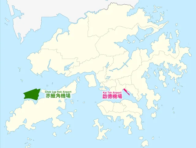
- Chek Lap Kok
Gerçekler
- The site originated from an unsuccessful private reclamation scheme before public acquisition for aviation.
- Runway expansion into Victoria Harbour allowed international jet airliners to land.
- Construction during wartime destroyed the historic stone wall of Kowloon Walled City.
- The airport ceased civilian operations when international traffic transferred to Chek Lap Kok.
Görsellerle Kai Tak Havaalanı7 fotoğraf · 1 yer
Ulaşım ve konaklama
Uçuş, havaalanı, ev sahipleri ve kiralık yerler
Burada henüz ücretsiz konaklama sağlayan ev sahibi bulunmuyor.
2 kaynak · 21 Eylül 2026 tarihi itibarıyla
Kaynak: TravelHub · OurAirports (public domain)
Yakındaki benzer yerler
Bütçe açısından benzer ve Kai Tak Havaalanı konumuna yakın
- Mesafe
- 3,8 km
- Mesafe
- 3,9 km
Hong Kong şehirleri
Kai Tak Havaalanı içindeki yerler
Aradığınız yeri bulamadınız mı? Arama motoru her dili anlar. Aramayı aç