
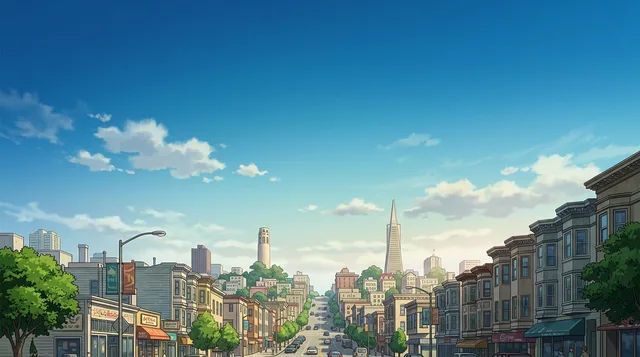
San Francisco: Guía de viajes, precios y alojamiento gratuito · 2026
Newcomers quickly learn to walk or board Muni rather than leave a car on the street, though covering essential monthly outlays still takes $8,479.
- BART train from SFO
- 11,15 $
- Single ticket
- 2,85 $
- Tarjeta SIM local
- 35 $
Fuentes: 3 · A fecha de 5 de septiembre de 2026
- Monthly pass
- 5,70 $
Riders tap contactless bank cards or mobile transit passes across city vehicles and regional rail.
- Café en barra
- 4,88 $
- Almuerzo en comedor
- 24 $
- Taxi, por km
- 2,12 $
- Habitación por mes
- ≈ 3670 $
- Tarjeta SIM
- 35 $
Fuentes: 5 · A fecha de 5 de septiembre de 2026
- 1 día
- Civic Center, Union Square, Financial District
- 3 días
- + Haight-Ashbury, Mission District, North Beach
- 7 días
- + Golden Gate Park, Ocean Beach, Nob Hill
A compact peninsula shaped by cold coastal fog, sharp vertical climbs, and staggering housing costs forces residents into daily compromises.
Daily navigation revolves around steep hills and distinct microclimates rather than automotive commuting. The urban core functions as a compact walking grid where streetcar routes, underground rail lines, and historic stairways connect residential districts. Leaving vehicles parked along curbs routinely leads to smashed windows, so long-term inhabitants rely on public transit networks and the shared tap card to traverse the terrain.
Seguir leyendo
Severe housing scarcity and tight planning laws keep rents among the highest in North America. Tech investment and medical research drive extreme local wealth, inflating the cost of groceries, clinic visits, and everyday restaurant lunches. This economic pressure forces lower-income households into outer regions, while central neighborhoods fill with upscale dining establishments and specialty food markets.
Distinct pockets preserve immigrant traditions, from longstanding taquerias in the Mission to bakeries across Chinatown. Alongside this culinary fabric, deep social fractures show clearly in districts like the Tenderloin, where severe homelessness and open drug scenes persist beside wealth. Coastal fog frequently blankets the bay during summer, bringing chilly afternoons that surprise residents expecting warm weather.
- Car break-ins
- Summer marine fog
- Mission burrito
- Clipper transit card
- Tenderloin street conditions
- The municipal government operates as the primary employer within the city, followed by the medical research university.
- Public health authorities maintain an ongoing syringe distribution program to mitigate infection risks across the urban center.
- Cioppino seafood stew was developed in North Beach by Italian fishermen adapting traditional maritime recipes.
- Direct rapid transit rail connects the international terminal to downtown subway stations without street-level vehicle traffic.
Las imágenes están vinculadas a los lugares en el mapa: cada foto tiene un autor y una licencia. Las imágenes similares de otra ciudad nunca aparecen aquí; si no hay fotos del lugar, no hay franja.
Dinero
Lo que realmente cuesta un mes y los precios de los productos cotidianos
- Café
- 4,88 $
- Almuerzo en comedor
- 24 $
- Billete de transporte único
- 2,85 $
- Habitación, al mes
- 3670 $
- Tarjeta SIM
- 35 $
- Taxi, por km
- 2,12 $
Hasta el 50% de programas de intercambio, prácticas y servicios del ecosistema pueden cubrirse con puntos.
6 fuentes · A fecha de 5 de septiembre de 2026
Cómo llegar y dónde quedarse
Primero lo gratis, luego lo de pago
Todavía no hay anfitriones que ofrezcan alojamiento gratuito en San Francisco. La ciudad más cercana con anfitriones es:
Establece tu ciudad de salida y mostraremos los precios de los vuelos por mes desde nuestra caché.
- BART train from SFO
- 11,15 $
- 01Acquire local cellular service or activate digital data to bypass airport markups.
- 02Withdraw physical currency from an airport automated teller when cash is required.
- 03Board the regional rapid transit line directly from the international concourse to downtown.
- 04Transfer to municipal transit lines or proceed to check in at lodgings without leaving luggage unattended.
4 fuentes · A fecha de 5 de septiembre de 2026
Visado y aspectos prácticos
Elegir un pasaporte
El resultado del visado se calcula para el par «pasaporte → país»: los plazos, tasas y documentos varían según el pasaporte. Elige un pasaporte y la información se mostrará aquí.
Las prácticas, Au Pair y programas de estudio requieren una categoría de visado distinta y un conjunto diferente de documentos. La solicitud se realiza a través de los programas internacionales IEC, no mediante un centro de visados turísticos.
Programas internacionales IEC- Major transit corridors such as Market Street forbid left turns across intersections, requiring drivers to circle blocks through right turns instead.
- Passengers must tap a transit card or purchase tickets at station kiosks before boarding Caltrain, as fares are not sold on trains.
- Tarjetas
- Efectivo
- Propinas
How do travelers reach downtown from San Francisco International Airport?
BART trains connect the airport directly to downtown stations. Travelers can also take regional public buses or hail metered taxis from the arrivals level. Pre-booked private transfers offer fixed arrangements without reliance on public transit schedules.
Fuente: Wikivoyage · SFO Airport Transfer Guide 2026 - San Francisco | Airport Transfer PortalHow can visitors protect rental vehicles from property theft?
Smash-and-grab car break-ins represent the most common property crime across the city, especially in tourist parking lots and viewpoints. Drivers should remove all personal belongings, bags, and electronic equipment so nothing remains visible in the vehicle. Travelers should drop their luggage at their lodging immediately upon arrival instead of stopping for sightseeing with loaded vehicles.
Fuente: Wikivoyage · Is San Francisco, USA Safe in 2026? Crime, Scams & Travel TipsWhat clothing is appropriate for summer weather in the city?
Summer months in San Francisco are characterized by dense fog, brisk winds, and cool conditions. Visitors traveling from warmer surrounding Bay Area regions often find coastal temperatures much colder than expected. Packing windproof jackets, warm sweaters, and adaptable layers is essential for daily outings.
Fuente: Is San Francisco, USA Safe in 2026? Crime, Scams & Travel TipsHow does public transportation work within the city?
Muni manages the municipal transit network, encompassing city buses, subway routes, historic streetcars, and cable cars. BART provides regional heavy-rail transit linking downtown stations to other parts of the Bay Area. Riders can tap contactless payment cards or load credit onto Clipper cards to access these services.
Fuente: Wikivoyage · Fares - SFMTA · Is San Francisco, USA Safe in 2026? Crime, Scams & Travel TipsWhich dishes originated in San Francisco?
The Mission District developed its own style of large burritos, which are sold widely at local neighborhood taquerias. North Beach is the origin of cioppino, a seafood stew cooked in a tomato and wine broth. The city also created hybrid menu items such as sushi rolls rolled to burrito proportions.
Fuente: WikivoyageIs San Francisco practical to navigate on foot?
The city features compact commercial corridors and mixed-use neighborhoods that support pedestrian travel. Many streets feature steep hills that require extra physical effort, though public stairway paths and transit lines help bypass difficult inclines. Dense municipal transit connections allow travelers to reach major sights without renting a car.
Fuente: Wikipedia · Wikivoyage6 fuentes
Seguridad y salud
Consejos de viaje oficiales y mínimos médicos
Cómo llegar
Aeropuertos, distancias y transporte público
Cuándo ir e itinerarios
Cuándo venir y qué cabe en un día, tres días y una semana
- 09:00Civic CenterExamine the monumental municipal architecture and connect directly to downtown transit lines.
- 11:30Hallidie BuildingObserve the pioneering glass curtain wall facade in the central commercial district.
- 14:00Federal Reserve Bank BuildingInspect the historic financial district landmark near the central banking corridor.
- 10:00Haas-Lilienthal HouseStudy the preserved Victorian residential design and period timber construction.
- 13:00James C. Flood MansionView the brownstone masonry estate situated atop the Nob Hill ridge.
- 15:30Haight-AshburyWalk through the historic center of counterculture activism and residential architecture.
Ciudades de United States
Lugares en San Francisco
Países cercanos
Preguntas frecuentes sobre San Francisco
¿No has encontrado el lugar que necesitas? La búsqueda entiende cualquier idioma y crea la página en 10–15 segundos. Abrir búsqueda