Saltar al contenido
TravelHub
Estes Park · Estados Unidos

Parque nacional de las Montañas Rocosas: qué hay cerca, cómo llegar y cuándo ir · 2026

Living beside the Continental Divide means preparing for afternoon storms that slash temperatures in minutes and snowpack that lingers well into summer.

Mapa de lugares
Ahora en la ciudadParque nacional de las Montañas Rocosas-2 °CNoche despejadaactualizado 23:12Qué hay cerca1
Tipo de cambio1,00 $por 1 $USD — la moneda del paísa fecha de 3 nov 2026
Cargando el mapa

Qué hay alrededor1

A menos de dos horas
Sobre el lugar

High alpine terrain divides the weather systems between Estes Park and Grand Lake.

High elevation defines daily life around this wilderness, where montane woodlands give way to subalpine forests and exposed tundra. The Continental Divide bisects the territory, generating damp air and deeper snowbanks across the western slopes while sending drier drafts east. Anyone stationed here faces abrupt squalls and subfreezing cold at higher camps.

Seguir leyendo

Settlers arrived following mining rushes in the nearby ranges, eventually carving routes such as Trail Ridge Road over historic native passages. Working locally involves planning around long-lasting snowpack, which closes higher roads and delays the alpine wildflower bloom until midsummer. Lower trails thaw earlier, though evening chills require cold-weather layering year-round.

Asociaciones
  • Continental DivideSplits the park into two distinct climate zones with contrasting winter snowfall.
  • Trail Ridge RoadHistoric roadway tracing ancient routes across high alpine tundra.
  • Sudden blizzardsExtreme elevation shifts trigger rapid freezes and severe summer lightning storms.
Datos
  • The park covers an area of {fwd2} square kilometres across northern Colorado.
  • The headwaters of the Colorado River begin in the northwestern sector of the park.
  • Summer afternoon thunderstorms commonly trigger rapid temperature drops.
Fuente: Wikidata · Wikipedia
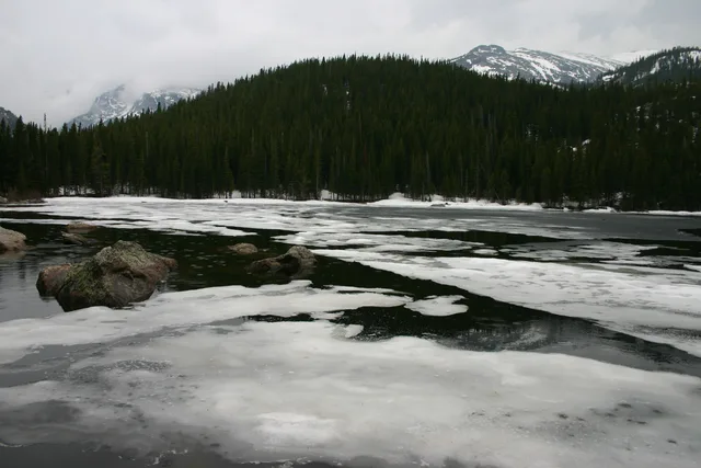
Parque nacional de las Montañas Rocosas en imágenes7 fotos
Charles M. Sauer -- Charlessauer · cc-by-sa-3.0 · 22 may 2007
Massimo Catarinella · cc-by-3.0 · 25 jun 2008
mark byzewski · cc-by-2.0 · 19 jun 2024

Cómo llegar y dónde quedarse

2 fuentes · A fecha de 4 de noviembre de 2026
Fuente: TravelHub · OurAirports (public domain)

Reseñas de Google

Lo que escriben los visitantes en Google Maps

La valoración y las reseñas recientes de Google Maps se cargan a petición.

Abrir en Google Maps